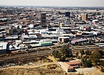
East Rand, Gauteng
| East Rand | ||||||||
|---|---|---|---|---|---|---|---|---|
|
||||||||
| Country | South Africa | |||||||
| Province | Gauteng | |||||||
| Municipality | Ekurhuleni | |||||||
| Government | ||||||||
| • Mayor | Mzwandile Masina | |||||||
| Area | ||||||||
| • Total | 1,975 km2 (763 sq mi) | |||||||
| Population | ||||||||
| • Total | 3,178,470 | |||||||
| • Density | 1,600/km2 (4,200/sq mi) | |||||||
| Racial makeup () | ||||||||
| • Black African | 78.7% | |||||||
| • Coloured | 2.7% | |||||||
| • Indian/Asian | 2.1% | |||||||
| • White | 15.8% | |||||||
| First languages () | ||||||||
| • Zulu | 28.8% | |||||||
| • English | 12.0% | |||||||
| • Afrikaans | 11.9% | |||||||
| • Northern Sotho | 11.4% | |||||||
| • Other | 35.9% | |||||||
| PO box | 1462 | |||||||
| HDI |
|
|||||||
| GDP | US$ 55.3 billion | |||||||
| GDP per capita | US$ 17,361 | |||||||
Coordinates: 26°10′38″S 28°13′19″E / 26.17722°S 28.22194°E
The East Rand is the name of the urban eastern part of the Witwatersrand that is functionally merged with the Johannesburg conurbation. This area became settled by Europeans after a gold-bearing reef was discovered in 1886 and sparked the gold rush that gave rise to the establishment of Johannesburg.
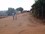
The large black townships of the East Rand were the scene of heavy clashes between the African National Congress and the Inkatha Freedom Party before the end of Apartheid.
The region extends from Germiston in the west to Springs in the east, and south down to Nigel, and includes the towns of Boksburg, Benoni, Brakpan, Kempton Park, Edenvale, and Bedfordview.
...
Wikipedia


