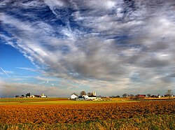
East Hempfield Township, Lancaster County, Pennsylvania
| East Hempfield Township, Lancaster County, Pennsylvania |
||
|---|---|---|
| Township | ||

A farm in East Hempfield Township
|
||
|
||
 Map of Lancaster County highlighting East Hempfield Township |
||
| Country |
|
|
| State |
|
|
| County | Lancaster | |
| Settled | 1717 | |
| Incorporated | 1818 | |
| Population (2010) | ||
| • Total | 23,522 | |
| Time zone | Eastern (EST) (UTC-5) | |
| • Summer (DST) | EDT (UTC-4) | |
| Area code(s) | 717 | |
| Website | easthempfield.org | |
East Hempfield Township is a township in west-central Lancaster County, Pennsylvania, United States. At the 2010 census the population was 23,522.
East Hempfield is one of the six immediate suburbs of the city of Lancaster, all sharing the same official designation as Lancaster, Pennsylvania by the United States Postal Service.
The Landis Mill Covered Bridge, Shenk's Mill Covered Bridge, Christian Habeck Farm, and Samuel N. Mumma Tobacco Warehouse are listed on the National Register of Historic Places.
According to the U.S. Census Bureau, the township has a total area of 21.1 square miles (55 km2), all of it land.
As of the census of 2000, there were 21,399 people, 8,552 households, and 6,054 families residing in the township. The population density was 1,011.6 people per square mile (390.6/km²). There were 8,761 housing units at an average density of 414.2/sq mi (159.9/km²). The racial makeup of the township was 93.45% White, 1.51% Black or African American, 0.11% Native American, 2.56% Asian, 1.51% from other races, and 0.86% from two or more races. 2.78% of the population were Hispanic or Latino of any race.
...
Wikipedia

