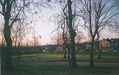
East End Park, Leeds
| East End Park | |
|---|---|
 View from East End Park |
|
| East End Park shown within West Yorkshire | |
| Metropolitan borough | |
| Metropolitan county | |
| Region | |
| Country | England |
| Sovereign state | United Kingdom |
| Post town | LEEDS |
| Postcode district | LS9 |
| Dialling code | 0113 |
| Police | West Yorkshire |
| Fire | West Yorkshire |
| Ambulance | Yorkshire |
| EU Parliament | Yorkshire and the Humber |
East End Park is an inner city area of east Leeds, West Yorkshire, England. It is situated between Burmantofts to the north west, Harehills to the north east (although not a direct neighbour), Halton Moor to the east, Richmond Hill to the west and Cross Green to the south west. It blends into the Halton Moor/Osmondthorpe area and is 1 mile to the east of Leeds city centre in the LS9 Leeds postcode area.
The area is situated in the vicinity of the A64 York Road, east Leeds' main thoroughfare, and is also home to a large park dating back from Victorian times which was purchased by Leeds City Council in the late 19th century, when it was waste land. Housing in the area is made up of nineteenth-century through terraced housing, some back-to-back terraced housing. Semi-detached and detached houses are also found in the area. Many of the back-to-back terraced houses in the area were due to be demolished as part of the £1.3 billion EASEL regeneration scheme in east and south east Leeds. However these plans were withdrawn in 2010 with Leeds City Council citing the recession debilitating the private sector's ability to build as the main reason.
Crime is unevenly distributed across East End Park. The Glensdales, Templeviews and Charltons are a small cluster of predominately back-to-back streets noted for the majority of the area's crime and have subsequently become a priority area of West Yorkshire Police, crime in the rest of the estate is much less common. The same group of streets are a focus of some regeneration in the area.
...
Wikipedia

