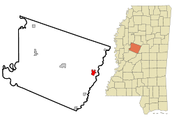
Durant, Mississippi
| Durant, Mississippi | |
|---|---|
| City | |
 Location of Durant, Mississippi |
|
| Location in the United States | |
| Coordinates: 33°4′35″N 89°51′23″W / 33.07639°N 89.85639°WCoordinates: 33°4′35″N 89°51′23″W / 33.07639°N 89.85639°W | |
| Country | United States |
| State | Mississippi |
| County | Holmes |
| Government | |
| • Mayor | Tasha Boyette-Davis |
| Area | |
| • Total | 2.3 sq mi (5.8 km2) |
| • Land | 2.2 sq mi (5.8 km2) |
| • Water | 0.0 sq mi (0.1 km2) |
| Elevation | 259 ft (79 m) |
| Population (2010) | |
| • Total | 2,673 |
| • Density | 1,162.1/sq mi (508.3/km2) |
| Time zone | Central (CST) (UTC-6) |
| • Summer (DST) | CDT (UTC-5) |
| ZIP code | 39063 |
| Area code(s) | 662 |
| FIPS code | 28-20500 |
| GNIS feature ID | 0669521 |
Durant is a city in Holmes County, Mississippi. It was founded in 1858 as a station on the Mississippi Central Railroad, later part of the Illinois Central. Durant was named for Louis Durant, a Choctaw chief who had lived on a bluff just across the nearby Big Black River before Indian Removal.
Before the Civil War, this was known as the "dark corner of the county." It was an area of cotton plantations and numerous enslaved African-American workers. The area is largely rural and agricultural. The population of the city was 2,932 at the 2000 census.
Sister Paula Merrill, a nurse practitioner with the Sisters of Charity of Nazareth in Kentucky, and Sister Margaret Held, a nurse practitioner with the School Sisters of St. Francis in Milwaukee, both aged 68, were found dead Thursday, August 25, 2016, in their home on Castalian Springs Road in Durant; the two women had been stabbed to death. A felon, Rodney Earl Sanders (aged 46), from nearby Kosciusko, was charged with the murders.
Durant is located at 33°4′35″N 89°51′23″W / 33.07639°N 89.85639°W (33.076313, -89.856405).
According to the United States Census Bureau, the city has a total area of 2.2 square miles (5.7 km2), of which 2.2 square miles (5.7 km2) is land and 0.04 square miles (0.10 km2) (0.89%) is water.
As of the census of 2010, there were 2,673 people, 1,171 households, and 978 families residing in the city. The population density was 1,316.4 people per square mile (507.6/km²). There were 1,209 housing units at an average density of 542.8 per square mile (209.3/km²). The racial makeup of the city was 13.80% White, 85.29% African American, 0.22% Native American, 0% Asian, 0.29% from other races, and 0.33% from two or more races. Hispanic or Latino of any race were 0.26% of the population.
...
Wikipedia

