Dunsfold
| Dunsfold | |
|---|---|
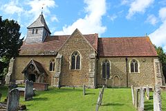
 Church of St. Mary and All Saints |
|
| Dunsfold shown within Surrey | |
| Area | 16.06 km2 (6.20 sq mi) |
| Population | 989 (Civil Parish 2011) |
| • Density | 62/km2 (160/sq mi) |
| OS grid reference | TQ006361 |
| Civil parish |
|
| District | |
| Shire county | |
| Region | |
| Country | England |
| Sovereign state | United Kingdom |
| Post town | Godalming |
| Postcode district | GU8 |
| Dialling code | 01483 |
| Police | Surrey |
| Fire | Surrey |
| Ambulance | South East Coast |
| EU Parliament | South East England |
| UK Parliament | |
Dunsfold is a village in the borough of Waverley, Surrey, England, 8.7 miles (14 kilometres) south of Guildford. It lies in the Weald and reaches in the north the southern escarpment of the Greensand Ridge. It includes the Wey and Arun Canal, and just under half of Dunsfold Aerodrome, which is shared with Alfold.
The village's name was recorded as Duntesfaude in 1259, Duntesfaud in 1272 and Duntesfalde in 1291, apparently meaning Dunt's fold. Alternatively it may be derived from the Old English (and Celtic) dun (hill i.e. down) and fold (enclosure). Either way folding means enclosing with fences, a way of moving sheep around the land to graze off the remains of previously harvested crops. It still emulated in modern sheep farming with and without pens around the village. There are some prize-winning Aberdeen Angus cattle farmed here but the last dairy herd has now closed.
St Mary & All Saints' Church is a Norman building, containing the oldest pews in England. The nearby Holy Well was a site of pilgrimage — its waters were thought to cure diseases of the eye. It would be consistent with the topography of the site that the well be a pre-Christian site and the church itself be constructed on a man-made hill of pre-Christian origin. The current rector is Paul Jenkins who has been installed since 23 January 2007.
Three manors were here, all had more cultivated fields, in order of size: Burningfold, Field Place and Graffham Grange.
The 5th Viscount Montagu (d. 1767) held this largest estate from a purchase from a Mr Tanner in 1751 until 1756 and his son sold it to Edmund Woods jun. in 1790. Owner Charlotte Woods built and endowed the first school, on the Green in 1850.
Held by Emery Cranley, it briefly split by moiety title between Quenell and Stoughton sisters (both born Cranley), was reunited by Peter Quenell then sold 1651 (to William Yalden) and 1677 (to William Sadler). In 1850 of James Sadler of Chiddingfold held it, by which time its main economy legacy was Field Place, a small manor house, with "a most delightful collection" of roofs of many of pitches and dispositions.
...
Wikipedia

