Duluth Airport
| Duluth International Airport | |||||||||||||||
|---|---|---|---|---|---|---|---|---|---|---|---|---|---|---|---|
 |
|||||||||||||||
| Summary | |||||||||||||||
| Airport type | Public | ||||||||||||||
| Owner | City of Duluth, Minnesota | ||||||||||||||
| Operator | Duluth Airport Authority | ||||||||||||||
| Serves | Duluth, Minnesota and Superior, Wisconsin (Twin Ports) | ||||||||||||||
| Location | St Louis County, Minnesota, USA | ||||||||||||||
| Elevation AMSL | 1,428 ft / 435 m | ||||||||||||||
| Coordinates | 46°50′32″N 092°11′37″W / 46.84222°N 92.19361°WCoordinates: 46°50′32″N 092°11′37″W / 46.84222°N 92.19361°W | ||||||||||||||
| Website | www.DuluthAirport.com | ||||||||||||||
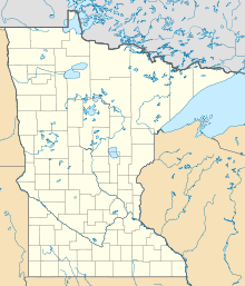
| Map | |||||||||||||||
| Location of the airport in Minnesota / United States | |||||||||||||||
| Runways | |||||||||||||||
|
|||||||||||||||
| Statistics | |||||||||||||||
|
|||||||||||||||
|
Sources: Airport website,FAA
|
|||||||||||||||
| Passengers (2016) | 245,000 |
|---|---|
| Aircraft operations (2015) | 56,108 |
| Based aircraft (2017) | 86 |
Duluth International Airport (IATA: DLH, ICAO: KDLH, FAA LID: DLH) is a city owned, public use joint civil-military airport located five nautical miles (9 km) northwest of the central business district of Duluth, a city in Saint Louis County, Minnesota, United States. It serves the Twin Ports area, including Superior, Wisconsin. Mostly used for general aviation but also served by three airlines, it is Minnesota's third-busiest airport, behind Minneapolis–St. Paul International Airport (MSP) and Rochester International Airport; and the state's second busiest commercial passenger airport, after MSP.
The Minnesota Air National Guard's 148th Fighter Wing, equipped with F-16C Fighting Falcons, is based at Duluth Air National Guard Base.
The City of Duluth purchased the original property for the airport in 1929 from Saint Louis County. The airport was constructed on 640 acres (2.6 km2) of land with two 2,650-foot (810 m) sod runways. In 1930, the airfield was dedicated as Williamson–Johnson Municipal Airport.
In 1940, Northwest Airlines began the first regularly scheduled air service to Duluth. Two years later, operations were temporarily halted by World War II.
In 1942, the three existing runways were paved. Each runway was 4,000 feet (1,200 m) long, 150 feet (46 m) wide, and at nearly equal angles from each other, 30, 90, and 130 degrees. They were identified as runways 3–21, 9–27, and 13–31 respectively. The Corps of Engineers extended Runways 9–27 and 3–21 to 5,699 feet (1,737 m) in 1945. In 1951, the USAF extended Runway 9–27 to 9,000 feet (2,700 m) with a 1,000-foot (300 m) overrun and the control tower was built. Runway 9–27 was rebuilt in 1956 and extended in 1966 to 10,152 feet (3,094 m) in length.
...
Wikipedia


