Dudh Koshi
| Dudh Koshi | |
|---|---|
 |
|
| Country | Nepal |
| Basin features | |
| Main source | East of Gokyo Lakes 27°56′05″N 86°42′34″E / 27.9347°N 86.7094°E |
| River mouth |
Sun Kosi near Harkapur 27°08′58″N 86°26′00″E / 27.1494°N 86.4333°ECoordinates: 27°08′58″N 86°26′00″E / 27.1494°N 86.4333°E |
| River system | Koshi River |
| Tributaries |
|
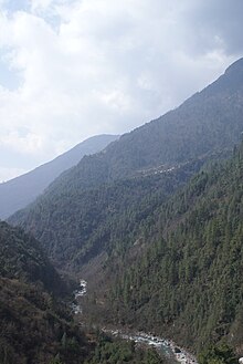
Dudh Koshi (दुधकोशी नदी, Milk-Koshi River) is a river in eastern Nepal. It is the highest river in terms of elevation.
The Kosi River, or Sapt Koshi, drains eastern Nepal. It is known as Sapt Koshi because of the seven rivers which join together in east-central Nepal to form this river. The main rivers forming the Koshi system are – the Sun Koshi(सुन कोशी), the Indravati River(इन्द्रावती), the Bhote Koshi (भोटे कोशी), the Dudh Koshi(दुध कोशी), the Arun River(अरुण), Barun River(बरुण), and Tamor River(तमोर). The Dudh Kosi river originates from the high-altitude areas of Mt Everest (8848 metres) and the snow and glacier melt contributes significant portion of streamflow, especially during the dry season. The combined river flows through the Chatra Gorge in a southerly direction to emerge from the hills.
The river drains the Mount Everest massif, the highest peak in the world. It begins just east of Gokyo Lakes and flows south to Namche Bazaar. Continuing south, the Dudh Koshi exits Sagarmatha National Park and passes to the west of Lukla. The Lamding Khola joins the Dudh Koshi to the southwest of Surkya and continues its southerly course to Harkapur, where it joins the Sun Kosi.
The river is characteristic of extreme white water and normally cannot be used for watersports. The descent is over 5% and there are rapids that reach WW VI difficulty (not yet rated by AWA) and places that need to be portaged even with the best equipment. In addition, the river often changes — big stones getting moved around by natural forces etc.
...
Wikipedia
