Doubrava (Karviná)
| Doubrava | |||
|---|---|---|---|
| Village | |||

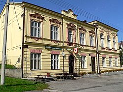
Národní dům (National House)
|
|||
|
|||
| Location in the Czech Republic | |||
| Coordinates: 49°51′33″N 18°28′11″E / 49.85917°N 18.46972°E | |||
| Country | Czech Republic | ||
| Region | Moravian-Silesian | ||
| District | Karviná | ||
| First mentioned | 1229 | ||
| Government | |||
| • Mayor | Pavel Krsek | ||
| Area | |||
| • Total | 7.77 km2 (3.00 sq mi) | ||
| Elevation | 235 m (771 ft) | ||
| Population (2012) | |||
| • Total | 1,273 | ||
| • Density | 160/km2 (420/sq mi) | ||
| Postal code | 735 33 | ||
| Website | Official website | ||
![]() Doubrava (1920-1924: Dombrová) (Polish: Dąbrowa , German: Dombrau) is a village in Karviná District, Moravian-Silesian Region, Czech Republic. It has a population of 1,507 (2006) and lies in the historical region of Cieszyn Silesia.
Doubrava (1920-1924: Dombrová) (Polish: Dąbrowa , German: Dombrau) is a village in Karviná District, Moravian-Silesian Region, Czech Republic. It has a population of 1,507 (2006) and lies in the historical region of Cieszyn Silesia.
The name of the village comes from the Slavic for "oak" (Polish: dąb, Czech: dub) and means "oak forest".
It is not clear when the village was founded. It was first mentioned in the document of Pope Gregory IX issued in 1229 among villages belonging to Benedictine abbey in Tyniec, as Dubrowa. In 1268 it was bestowed by Władysław Opolski to the newly established Benedictine abbey in Orlová.
Politically it belonged then to the Duchy of Opole and Racibórz and Castellany of Cieszyn, which was in 1290 formed in the process of feudal fragmentation of Poland and was ruled by a local branch of Piast dynasty. In 1327 the duchy became a fee of the Kingdom of Bohemia, which after 1526 became part of the Habsburg Monarchy. In 1573 it was sold as one of a dozen villages and the town of Freistadt and formed a state country split from the Duchy of Teschen.
...
Wikipedia


