Dinas, Zamboanga del Sur
| Dinas | |
|---|---|
| Municipality | |
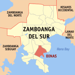
 Map of Zamboanga del Sur with Dinas highlighted |
|
| Location within the Philippines | |
| Coordinates: 07°38′N 123°18′E / 7.633°N 123.300°ECoordinates: 07°38′N 123°18′E / 7.633°N 123.300°E | |
| Country | Philippines |
| Region | Zamboanga Peninsula (Region IX) |
| Province | Zamboanga del Sur |
| District | 2nd district, Zamboanga del Sur |
| Founded | June 17, 1950 |
| Barangays | 30 |
| Government | |
| • Mayor | Basilio A. Vidad |
| Area | |
| • Total | 121.10 km2 (46.76 sq mi) |
| Population (2015 census) | |
| • Total | 35,504 |
| • Density | 290/km2 (760/sq mi) |
| Time zone | PST (UTC+8) |
| ZIP code | 7015 |
| IDD : area code | +63 (0)62 |
| Income class | 4th municipal income class |
| 097306000 | |
| Electorate | 18,924 voters as of 2016 |
| Website | www |
Dinas is a fourth class municipality in the province of Zamboanga del Sur, Philippines. According to the 2015 census, it has a population of 35,504 people.
Dinas has historically been known as the bulwark of anti-Hispanic colonization in the entire Baganian Peninsula of Zamboanga del Sur. According to ancient history which has been accepted and advocated by the scions of Sultan Kudarat, a descendant of the renowned Shariff Kabungsuan of Maguindanao was that the name Dinas was taken from a Maguindanao term Di Nas where “Di” means “Not” and “Nas” means “Bad Luck or Unlucky”. Hence, the early settlers who migrated from the province of Cotabato found their new haven as not unlucky or “Di Nas” because the mouths of all rivers emptying into the coastlines are facing East which according to their ancient belief is a sign of good luck. Today almost thirty per cent of the population are Maguindanaon Muslims.
Dinas is politically subdivided into 30 barangays.
...
Wikipedia

