Dinapigue
| Dinapigue | ||
|---|---|---|
| Municipality | ||

View of the forested coast of Dinapigue
|
||
|
||
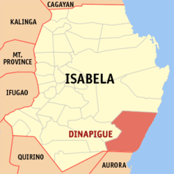
 Map of Isabela showing the location of Dinapigue |
||
| Location within the Philippines | ||
| Coordinates: 16°40′N 122°21′E / 16.67°N 122.35°ECoordinates: 16°40′N 122°21′E / 16.67°N 122.35°E | ||
| Country | Philippines | |
| Region | Cagayan Valley (Region II) | |
| Province | Isabela | |
| District | 6th District of Isabela | |
| Founded | 1969 | |
| Barangays | 6 | |
| Government | ||
| • Mayor | Reynaldo del Rosario Derije | |
| • Vice Mayor | Herminio Domincel | |
| • Electorate | 4,479 voters (2016 election) | |
| Area | ||
| • Total | 574.40 km2 (221.78 sq mi) | |
| Population (2015 census) | ||
| • Total | 5,005 | |
| • Density | 8.7/km2 (23/sq mi) | |
| Time zone | PST (UTC+8) | |
| ZIP code | 3336 | |
| 023110000 | ||
| IDD : area code | +63 (0)78 | |
| Income class | 1st municipal income class | |
| Poverty incidence | 25.81 (2012) | |
| Website | www |
|
Dinapigue is a 1st class municipality in the province of Isabela, Philippines. According to the 2015 census, it has a population of 5,005 people.
It is also called Dinapigui.
Dinapigue is politically subdivided into 6 barangays.
In the 2015 census, the population of Dinapigue was 5,005 people, with a density of 8.7 inhabitants per square kilometre or 23 inhabitants per square mile.
Dinapigue is accessible by land but this isolated town can also be accessed by air through Dinapigue Airport.
...
Wikipedia


