Diemerswil
| Diemerswil | ||
|---|---|---|
|
||
| Coordinates: 47°1′N 7°26′E / 47.017°N 7.433°ECoordinates: 47°1′N 7°26′E / 47.017°N 7.433°E | ||
| Country | Switzerland | |
| Canton | Bern | |
| District | Bern-Mittelland | |
| Area | ||
| • Total | 2.86 km2 (1.10 sq mi) | |
| Elevation | 600 m (2,000 ft) | |
| Population (Dec 2015) | ||
| • Total | 204 | |
| • Density | 71/km2 (180/sq mi) | |
| Postal code | 3053 | |
| SFOS number | 0536 | |
| Surrounded by | Kirchlindach, Münchenbuchsee, Schüpfen | |
| Website |
http://www.diemerswil.ch SFSO statistics |
|
Diemerswil is a municipality in the Bern-Mittelland administrative district in the canton of Bern in Switzerland.
Diemerswil is first mentioned in 1257 as Diemarswile.
The earliest trace of people in the area is a Hallstatt culture grave mound with a cart or wagon, in the Brandwald. During the Middle Ages it belonged to the Herrschaft, court and parish of the Münchenbuchsee Commandery. After the Commandery was secularized in 1528, the village became part of the Bernese bailiwick of Münchenbuchsee. In 1803 it became part of the district of Fraubrunnen.
During the 19th century, many of local farmers began to raise dairy cattle instead of or in addition to their traditional crops. The village school was built in 1827, but students still have to travel to Münchenbuchsee for secondary school. The so-called Schloss, an elegant country manor house, was demolished in 1969. The village has remained generally rural and agricultural. In 2000 almost half of all working residents worked in agriculture. At the same time about half the residents commuted for work in other communities, especially Bern.
Diemerswil has an area of 2.86 km2 (1.10 sq mi). Of this area, 2.08 km2 (0.80 sq mi) or 72.7% is used for agricultural purposes, while 0.56 km2 (0.22 sq mi) or 19.6% is forested. Of the rest of the land, 0.17 km2 (0.066 sq mi) or 5.9% is settled (buildings or roads).
Of the built up area, housing and buildings made up 2.4% and transportation infrastructure made up 3.1%. Out of the forested land, all of the forested land area is covered with heavy forests. Of the agricultural land, 58.4% is used for growing crops and 11.9% is pastures, while 2.4% is used for orchards or vine crops.
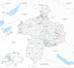
Diemerswil is located on the south east side of the Moos Lake valley and includes the hamlets of Dörfli, Kohlholz, Mettlen, Moos, Riedmatt and Wydacker. It belongs to the parish and greater community (Gemeindeverband) of Münchenbuchsee.
...
Wikipedia


