Diego Jiménez Torres Airport
|
Diego Jiménez Torres Airport Fajardo Airport |
|||||||||||
|---|---|---|---|---|---|---|---|---|---|---|---|
 |
|||||||||||
| Summary | |||||||||||
| Airport type | Public | ||||||||||
| Owner | Puerto Rico Ports Authority | ||||||||||
| Serves | Fajardo, Puerto Rico | ||||||||||
| Elevation AMSL | 64 ft / 20 m | ||||||||||
| Coordinates | 18°18′29″N 065°39′43″W / 18.30806°N 65.66194°WCoordinates: 18°18′29″N 065°39′43″W / 18.30806°N 65.66194°W | ||||||||||
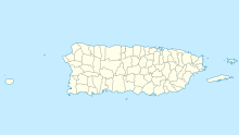
| Map | |||||||||||
| Location in Puerto Rico | |||||||||||
| Runways | |||||||||||
|
|||||||||||
| Statistics (1998) | |||||||||||
|
|||||||||||
|
Source: Federal Aviation Administration
|
|||||||||||
| Aircraft operations | 14,314 |
|---|---|
| Based aircraft | 14 |
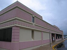
Diego Jiménez Torres Airport (IATA: FAJ, ICAO: TJFA, FAA LID: X95) is a public use airport owned by the Puerto Rico Ports Authority and located one nautical mile (1.85 km) southwest of the central business district of Fajardo, a city in Puerto Rico. It is also known as Fajardo Airport.
Airport operations were shut down in November 2008 and transferred to the newly opened José Aponte de la Torre Airport in Ceiba. However, as of July 2009, Diego Jiménez Torres Airport is still listed as an active airport by the Federal Aviation Administration.
As of February 2015 the FAA announced to permanently close the airport on April 30th, 2015.
Diego Jiménez Torres Airport covers an area of 95 acres (38 ha) at an elevation of 64 feet (20 m) above mean sea level. It has one asphalt paved runway designated 8/26 which measures 3,600 by 75 feet (1,097 x 23 m).
For the 12-month period ending March 16, 1998, the airport had 14,314 aircraft operations, an average of 39 per day: 90% air taxi and 10% general aviation. At that time there were 14 aircraft based at this airport: 71% single-engine, 21% multi-engine and 7% ultralight.
...
Wikipedia

