Delaplaine, Arkansas
| Delaplaine, Arkansas | |
|---|---|
| Town | |
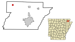
 Location in Greene County in the state of Arkansas |
|
| Coordinates: 36°13′58″N 90°43′33″W / 36.23278°N 90.72583°WCoordinates: 36°13′58″N 90°43′33″W / 36.23278°N 90.72583°W | |
| Country | United States |
| State | Arkansas |
| County | Greene |
| Area | |
| • Total | 1.1 sq mi (2.9 km2) |
| • Land | 1.1 sq mi (2.9 km2) |
| • Water | 0 sq mi (0 km2) |
| Elevation | 276 ft (84 m) |
| Population (2010) | |
| • Total | 116 |
| • Density | 105/sq mi (40.4/km2) |
| Time zone | Central (CST) (UTC-6) |
| • Summer (DST) | CDT (UTC-5) |
| ZIP code | 72425 |
| Area code(s) | 870 |
| FIPS code | 05-18010 |
| GNIS feature ID | 0076777 |
Delaplaine is a town in Greene County, Arkansas, United States. The population was 116 at the 2010 census.
Delaplaine was incorporated as a town in April 1912 but has a history that dates back to the time of the French explorations. Early settlers found remains of a French-Indian trading post at the site. When the St. Louis-Iron Mountain Railroad pushed lines into northern Arkansas in 1873 a station was established called Grey's Station. The name was later changed to the French "De La Plaine" (of the plain) in recognition of the earlier French trading post. The rail line provided the entire county with passenger and freight services, especially for the local timber industry. The county's first newspaper was published at Delaplaine in 1873 by James W. Wray.
Delaplaine is located in northwestern Greene County at 36°13′58″N 90°43′33″W / 36.23278°N 90.72583°W (36.232701, -90.725807).Arkansas Highway 90 passes through the town, leading northeast, then east, 31 miles (50 km) to Rector, and southwest, then northwest, 21 miles (34 km) to Pocahontas. Arkansas Highway 34 leads southeast from the center of town 16 miles (26 km) to Oak Grove Heights. Paragould, the Greene County seat, is 23 miles (37 km) to the southeast via Highways 34 and 135. Highway 34 joins Highway 90 to the southwest from Delaplaine and leads 17 miles (27 km) to Walnut Ridge. Arkansas Highway 304 leads west from Delaplaine on a more direct route of 16 miles (26 km) to Pocahontas.
...
Wikipedia
