Daman Airport
| Daman Airport | |||||||||||||||
|---|---|---|---|---|---|---|---|---|---|---|---|---|---|---|---|
| Summary | |||||||||||||||
| Airport type | Military | ||||||||||||||
| Operator | Indian Coast Guard | ||||||||||||||
| Location | Daman, India | ||||||||||||||
| Elevation AMSL | 10 m / 33 ft | ||||||||||||||
| Coordinates | 20°26′04″N 072°50′36″E / 20.43444°N 72.84333°ECoordinates: 20°26′04″N 072°50′36″E / 20.43444°N 72.84333°E | ||||||||||||||
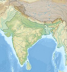
| Map | |||||||||||||||
| Runways | |||||||||||||||
|
|||||||||||||||
Daman Airport (IATA: NMB, ICAO: VADN) is a military airbase located at Daman in the Union Territory of Daman and Diu, India. It is home to the Indian Coast Guard Air Station, Daman which provides ATC and parking facilities to Defence as well as civilian aircraft.
Daman airport was built in the 1950s by the Government of Portuguese India. The TAIP (Portuguese India Airlines) commenced operations to Daman on 29 August 1955. TAIP linked Daman with Goa, Diu and Karachi until December 1961, when Daman was invaded by the Indian Armed Forces, with TAIP ceasing operations. The Indian Coast Guard deployed its first Dornier Squadron at Daman in January 1987 followed by its first full-fledged Air Station in October 1987.
Daman Airport has two intersecting asphalt runways. Main runway 03/21 is 5910 ft (1801 m) long and 45 m wide while secondary Runway 10/28 is 3284 ft (1001 m) long and 25 m wide.The Airport is equipped with state of art Airport Surveillance Radar (ASR), Precision Approach Path Indicator (PAPI), Doppler Very High Frequency Omni directional Radio Range (DVOR) – Distance Measuring Equipment (DME) & Non-Directional Beacon (NDB), as Navigational Aids.
The station has two squadrons under its administrative and operational control.
...
Wikipedia

