Cypremort Point State Park
| Cypremort Point State Park | |
|---|---|

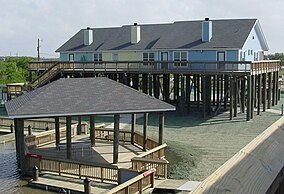
Cabins on the beach at the park
|
|
|
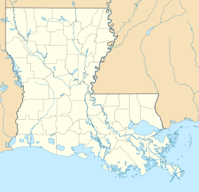
Map of Louisiana, United States of America
|
|
| Location | St. Mary Parish, Louisiana, United States of America |
| Coordinates | 29°44′14″N 91°51′12″W / 29.73722°N 91.85333°WCoordinates: 29°44′14″N 91°51′12″W / 29.73722°N 91.85333°W |
| Area | 185 acres (0.75 km2; 0.289 sq mi) |
| Established | November 20, 2004 |
| Governing body | Louisiana Office of State Parks |
| http://www.crt.state.la.us/parks/iCyprempt.aspx | |
Cypremort Point State Park is a public recreation area located on Vermilion Bay, Louisiana near the end of La. Hwy. 319. It is named for nearby Cypremort Point. Cypremort means "dead cypress" in French. The 185-acre (0.75 km2) park, set against a backdrop of coastal marsh, contains a half-mile stretch of man-made beach which contains picnic sites, a fishing pavilion and sailboat launch. Also, there are 6 cabins on the park grounds which may be reserved by guests. Chitimacha tradition says that one of 4 markers for their tribal land was a great cypress, at present-day Cypremort Point State Park. Cypremort Point is one of the few spots on the Louisiana Gulf coastline which may be accessed by road.
The park has a 100-foot (30 m) fishing pier. Crabbing, water skiing, windsurfing and sailing are common activities.
A visitor may see nutria, muskrat, alligator, or a number of bird species. Deer, black bear, rabbits, possum, and red fox also make their home in the area.
...
Wikipedia

