Curlwaa, New South Wales
|
Curlwaa New South Wales |
|
|---|---|

|
|
| Coordinates | 34°06′S 141°58′E / 34.100°S 141.967°ECoordinates: 34°06′S 141°58′E / 34.100°S 141.967°E |
| Population | 405 (2006 census) |
| Postcode(s) | 2648 |
| Location | 4 km (2 mi) east of Wentworth |
| LGA(s) | Wentworth Shire |
| State electorate(s) | Murray |
| Federal Division(s) | Farrer |
Curlwaa is a locality in New South Wales, Australia.
Curlwaa is an irrigation settlement a few kilometres upstream of Wentworth on the Murray River in far southwestern New South Wales. Curlwaa holds the distinction of being the first Government irrigation scheme in New South Wales, established in 1890.
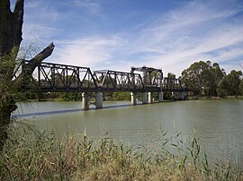
The Abbotsford Bridge spans the Murray River between Yelta, Victoria and Curlwaa, New South Wales. It was named after Joseph Palmer Abbott who was elected to the New South Wales Legislative Assembly in 1880 and later became the member for Wentworth in 1887. The bridge was opened on 10 July 1928 by the Admiral Sir Dudley de Chair KCB KBE MVO, Governor of New South Wales.
...
Wikipedia

