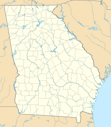
Cumberland Island National Seashore
| Cumberland Island National Seashore | |
|---|---|
|
IUCN category II (national park)
|
|
| Location | Camden County, Georgia, USA |
| Nearest city | St. Marys, Georgia |
| Coordinates | 30°50′N 81°27′W / 30.833°N 81.450°WCoordinates: 30°50′N 81°27′W / 30.833°N 81.450°W |
| Area | 36,415.39 acres (147.3679 km2) 18,700.34 acres (75.6776 km2) federal |
| Established | October 23, 1972 |
| Visitors | 40,291 (in 2005) |
| Governing body | National Park Service |
| Website | Cumberland Island National Seashore |
Cumberland Island National Seashore preserves most of Cumberland Island in Camden County, Georgia, the largest of Georgia's Golden Isles. The seashore features beaches and dunes, marshes, and freshwater lakes. The national seashore also preserves and interprets many historic sites and structures.
One of the people instrumental in the creation and preservation of the seashore was Carol Ruckdeschel.
The island is only accessible by boat. The Cumberland Island Visitor Center, Cumberland Island Museum, and Lang concession ferry to the island are located in the town of St. Marys, Georgia. Public access via the ferry is limited, reservations are recommended. Camping is allowed in the seashore. The 9,886-acre (40.01 km2) Cumberland Island Wilderness is part of the seashore.
The national seashore was authorized by Congress on October 23, 1972, and is administered by the National Park Service. The wilderness area was designated on September 8, 1982.
Cumberland Island National Seashore contains a dense diversity of coastal flora and fauna. The National Park Service employs a full-time wildlife manager and scientists, and hosts researchers periodically. The park contains at least 23 distinct ecological communities, making it the largest and most biodiverse of Georgia's barrier islands. Birds, particularly migratory waterfowl, have been studied.
The public areas of Cumberland Island are part of a national seashore managed by the National Park Service. NPS restricts access to 300 people on the island at a time, and campers are allowed to stay no more than seven nights. The island is only accessible by boat. The Cumberland Queen ferry runs three times a day from March 1 to September 30. From October 1 to November 31 it only runs twice a day. From December 1 to February 28 the boat runs twice a day only on Mondays - Thursdays to Cumberland Island from the mainland (St. Marys, Georgia). Visitors cannot bring vehicles on the ferry, and there are no paved roads or trails. Bikes are available for rent at the Sea Camp Dock, on a first-come, first-served basis. Visitors may bring their own bikes on the ferry to the island for an additional charge. There is one camping area with running water and bathrooms with cold showers; the other camping sites do not have facilities. All food, ice and supplies must be shipped from the mainland, as there are no stores on the island.
...
Wikipedia

