Cumberland
| Cumberland | |
|---|---|
 Flag |
|
 |
|
| Area | |
| • 1831 | 969,490 acres (3,923.4 km2)1831 Census cited in Vision of Britain – Ancient county data |
| • 1911 | 973,086 acres (3,937.94 km2) |
| • 1961 | 973,146 acres (3,938.18 km2) |
| Population | |
| • 1911 | 265,746Vision of Britain – Cumberland population (density and area) |
| • 1961 | 294,303 |
| Density | |
| • 1911 | 0.27/acre |
| • 1961 | 0.3/acre |
| History | |
| • Origin | Historic |
| • Created | 12th Century |
| • Abolished | 1974 |
| • Succeeded by | Cumbria |
| Status | Administrative county (1889–1974)Ceremonial county (until 1974) |
| Chapman code | CUL |
| Government | Cumberland County Council (1889–1974) |
| • HQ | Carlisle |
| Subdivisions | |
| • Type | Wards (ancient) |
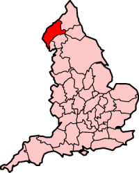
Cumberland (/ˈkʌmbələnd/ KUM-bə-lənd; locally /ˈkʊmbələnd/ KUUM-bə-lənd) is a historic county of North West England that had an administrative function from the 12th century until 1974. It was bordered by Northumberland to the east, County Durham to the southeast, Westmorland and Lancashire to the south, and Dumfriesshire in Scotland to the north. It formed an administrative county from 1889 to 1974 (excluding Carlisle from 1914) and now forms part of Cumbria. (In rhotic varieties of English, the pronunciation is kəmbərlənd, that is, with a plain "r" sound in the middle syllable.)
...
Wikipedia
