Culley Run
| Culley Run | |
|---|---|

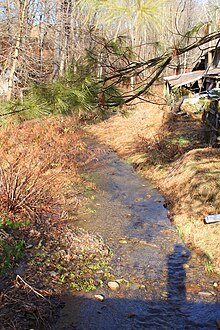
Culley Run looking upstream
|
|
| Other name(s) | Cully Run, Colley Run |
| Basin features | |
| Main source | valley between Steinbuck Road and Cully Run Road in Benton Township, Columbia County, Pennsylvania between 860 and 880 feet (260 and 270 m) |
| River mouth | Fishing Creek in Benton Township, Columbia County, Pennsylvania 718 ft (219 m) 41°10′38″N 76°23′13″W / 41.17727°N 76.38692°WCoordinates: 41°10′38″N 76°23′13″W / 41.17727°N 76.38692°W |
| Progression | Fishing Creek → Susquehanna River → Chesapeake Bay |
| Basin size | 1.45 sq mi (3.8 km2) |
| Physical characteristics | |
| Length | 1.45 mi (2.33 km) |
Culley Run (also known as Cully Run or Colley Run) is a tributary of Fishing Creek in Columbia County, Pennsylvania, in the United States. It is approximately 1.4 miles (2.3 km) long and flows through Benton Township. The stream's watershed has an area of 1.45 square miles (3.8 km2). Shale, sandstone, alluvium, and glacial till can be found in the watershed. At least one bridge crosses the stream. The stream is most likely named after Alexander Colley, Sr.
Culley Run begins in a valley in Benton Township between Steinbuck Road and Cully Run Road. It flows southeast for several hundred feet, alongside Cully Run Road. It then turns east for a short distance and then turns south, still following the road. After a few tenths of a mile, the stream crosses Pennsylvania Route 254 and turns east-southeast for several tenths of a mile, flowing alongside Pennsylvania Route 254. After several tenths of a mile, it crosses Pennsylvania Route 254 again. Several hundred feet further downstream, it reaches its confluence with Fishing Creek, not far from the community of Maple Grove.
Culley Run joins Fishing Creek 21.16 miles (34.05 km) upstream of its mouth.
The elevation near the mouth of Culley Run is 718 feet (219 m) above sea level. The elevation of the stream's source is between 860 and 880 feet (260 and 270 m) above sea level.
The Pennsylvania Department of Transportation has made plans to put 75 feet (23 m) of rock slope protection on the of Culley Run at a location 0.75 miles (1.21 km) west of the intersection of Pennsylvania Route 254 with Pennsylvania Route 487. This project was expected to permanently affect 75 feet (23 m) of Culley Run and 110 feet (34 m) of Fishing Creek. The Pennsylvania Department of Transportation also has a permit to maintain a box culvert made of reinforced concrete on the stream. This culvert is 14.0 feet (4.3 m) long and 5.5 feet (1.7 m) high and is sunk 1 foot (0.30 m) into the streambed.
...
Wikipedia
