Crystal Airport (Minnesota)
| Crystal Airport | |||||||||||||||||||||||
|---|---|---|---|---|---|---|---|---|---|---|---|---|---|---|---|---|---|---|---|---|---|---|---|
 |
|||||||||||||||||||||||
| Summary | |||||||||||||||||||||||
| Airport type | Public | ||||||||||||||||||||||
| Owner | Metropolitan Airports Commission | ||||||||||||||||||||||
| Serves | Minneapolis, Minnesota | ||||||||||||||||||||||
| Location | Crystal, Minnesota | ||||||||||||||||||||||
| Elevation AMSL | 869 ft / 265 m | ||||||||||||||||||||||
| Map | |||||||||||||||||||||||
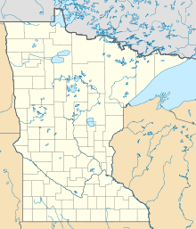
| Location of airport in Minnesota / United States | |||||||||||||||||||||||
| Runways | |||||||||||||||||||||||
|
|||||||||||||||||||||||
| Statistics | |||||||||||||||||||||||
|
|||||||||||||||||||||||
|
Source: Federal Aviation Administration
|
|||||||||||||||||||||||
| Aircraft operations (2014) | 42,351 |
|---|---|
| Based aircraft (2017) | 177 |
Coordinates: 45°03′43″N 093°21′14″W / 45.06194°N 93.35389°W
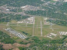
Crystal Airport (IATA: MIC, ICAO: KMIC, FAA LID: MIC) is a public airport named after the city of Crystal in Hennepin County, Minnesota, United States. Most of the airport is in the city of Crystal. Portions north of 62nd Avenue are in Brooklyn Park, and the north east corner of the airport is in Brooklyn Center. It is eight miles (13 km) northwest of the central business district of Minneapolis and is owned by the Metropolitan Airports Commission.
The airport opened in 1946 as a privately owned public use airport. In 1948 the Metropolitan Airports Commission purchased the airport. Additional land purchases were made in 1951 and 1954.
...
Wikipedia


