Crepori National Forest
| Crepori National Forest | |
|---|---|
| Floresta Nacional do Crepori | |
|
IUCN category VI (protected area with sustainable use of natural resources)
|
|

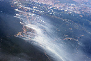
Fires clearing land along BR-163 to the east of the forest. Looking south towards deforested areas of Mato Grosso. Crepori National Forest is in the lower right of the image.
|
|
| Nearest city | Jacareacanga, Pará |
| Coordinates | 6°30′00″S 57°00′07″W / 6.500035°S 57.001821°WCoordinates: 6°30′00″S 57°00′07″W / 6.500035°S 57.001821°W |
| Area | 739,806 ha (2,856.41 sq mi) |
| Designation | National forest |
| Created | 13 February 2006 |
| Administrator | Chico Mendes Institute for Biodiversity Conservation |
The Crepori National Forest (Portuguese: Floresta Nacional do Crepori) is a national forest in the state of Pará, Brazil. The forest allows sustainable use of natural resources, and mining. It is home to rich biodiversity including several endangered animal species.
The Crepori National Forest is in the municipality of Jacareacanga, Pará. It has an area of 739,806 hectares (1,828,100 acres). It adjoins the Tapajós Environmental Protection Area to the north and east and the Mundurucu Indigenous Territory to the west. The northernmost part of the forest is in the Southern Pará Peripheral Depression, the central and eastern part in the Tapajós Residual Plateau and the southern and southwestern parts in the Amazon Lower Plateau domain. Altitudes range from 100 to 300 metres (330 to 980 ft).
The forest takes its name from the Crepori River, an important right tributary of the Tapajós, which rises in the Serra do Cachimbo at 450 metres (1,480 ft) on the border between the municipalities of Itaituba and Jacareacanga. The river's main tributaries are the Marupá River, a left tributary that enters the Crepori about 3 kilometres (1.9 mi) upstream from the settlement of Creporizão, the Creporizinho River, a right tributary that rises at 320 metres (1,050 ft) and the Piranhas River, a right tributary that rises at 335 metres (1,099 ft).
The Crepori National Forest was created by federal decree on 13 February 2006 with the objectives of promoting sustainable multiple use of forest resources, maintenance and protection of water resources and biodiversity, and development of methods for sustainable exploitation of natural resources. Mining is allowed in specified areas. The park is administered by the Chico Mendes Institute for Biodiversity Conservation. It is classed as IUCN protected area category VI (protected area with sustainable use of natural resources).
The consultative council was created on 14 May 2009. On 17 November 2009 a working group was created to coordinate preparation of management tools for the Amaná, Crepori, Altamira, Jamanxim, Trairão, Itaituba I and Itaituba II national forests in the state of Pará. The management plan was approved on 10 March 2010.
...
Wikipedia

