County of Nottingham
| Nottinghamshire | |||
|---|---|---|---|
| County | |||
|
|||
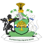
| Motto: Sapienter proficiens (Progress with wisdom) | |||
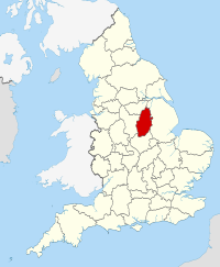
 Nottinghamshire in England |
|||
| Sovereign state |
|
||
| Country |
|
||
| Region | East Midlands | ||
| Established | Historic | ||
| Ceremonial county | |||
| Area | 2,160 km2 (830 sq mi) | ||
| • Ranked | 27th of 48 | ||
| Population (mid-2015 est.) | 1,124,700 | ||
| • Ranked | 15th of 48 | ||
| Density | 520/km2 (1,300/sq mi) | ||
| Ethnicity | 94.1% White British/Irish/Other 2.5% South Asian 1.5% Afro-Caribbean |
||
| Non-metropolitan county | |||
| County council |
Nottinghamshire County Council http://www.nottscc.gov.uk/ |
||
| Executive | Labour | ||
| Admin HQ | West Bridgford | ||
| Area | 2,085 km2 (805 sq mi) | ||
| • Ranked | 24th of 27 | ||
| Population | 805,800 | ||
| • Ranked | 10th of 27 | ||
| Density | 386/km2 (1,000/sq mi) | ||
| ISO 3166-2 | GB-NTT | ||
| ONS code | 37 | ||
| NUTS | UKF15/16 | ||
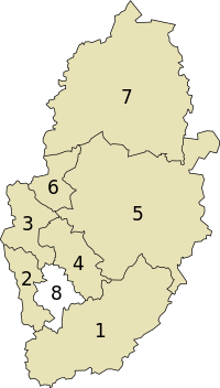
 Districts of Nottinghamshire |
|||
| Districts | |||
| Members of Parliament | |||
| Time zone | GMT (UTC) | ||
| • Summer (DST) | BST (UTC+1) | ||
Nottinghamshire (pronounced /ˈnɒtɪŋəmʃər/ or /ˈnɒtɪŋəmˌʃɪər/; abbreviated Notts) is a county in the East Midlands of England, bordering South Yorkshire to the north-west, Lincolnshire to the east, Leicestershire to the south, and Derbyshire to the west. The traditional county town is Nottingham, though the county council is based in West Bridgford in the borough of Rushcliffe, at a site facing Nottingham over the River Trent.
The districts of Nottinghamshire are Ashfield, Bassetlaw, Broxtowe, Gedling, Mansfield, Newark and Sherwood, and Rushcliffe. The City of Nottingham was administratively part of Nottinghamshire between 1974 and 1998 but is now a unitary authority, remaining part of Nottinghamshire for ceremonial purposes.
...
Wikipedia


