Coulsdon and Purley Urban District Council
| Coulsdon and Purley | |
|---|---|
| Urban district | |

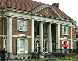
Council Offices in Purley
|
|
| Area | |
| • 1921 | 8,572 acres (34.69 km2) |
| • 1961 | 11,143 acres (45.09 km2) |
| Area transferred | |
| • 1929 | 59 acres from Godstone Rural District |
| • 1933 | 2,551 acres (net) from adjacent districts |
| • 1936 | 39 acres (net) to County Borough of Croydon |
| Population | |
| • 1921 | 21,491 |
| • 1961 | 74,926 |
| Density | |
| • 1921 | 2.5/acre |
| • 1961 | 6.7/acre |
| History | |
| • Created | 1915 |
| • Abolished | 1965 |
| • Succeeded by | London Borough of Croydon |
| Status | Urban district |
| Government | Coulsdon and Purley Urban District Council |
| • HQ | Council Offices, Brighton Road, Purley |
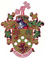
| • Motto | Animo et Fide (By Courage and Faith) |
 Coat of arms |
|
Coulsdon and Purley Urban District was a local government district in northeast Surrey from 1915 to 1965. The local authority was Coulsdon and Purley Urban District Council. The former area of the district is now mostly part of the London Borough of Croydon in Greater London, with parts in the Tandridge District and the Borough of Reigate and Banstead in Surrey.
The population of Croydon Rural District doubled from 1901 to 1911 as suburban house building took place, with 11,389 in Coulsdon and 2,853 in Sanderstead in 1911. In both cases, the population was much higher than would be typical for rural parishes. Surrey County Council made an order in 1914 to abolish the rural district and this was completed in 1915. The new Coulsdon and Purley Urban District consisted of the parish of Coulsdon, including the settlements of Coulsdon and Purley, and the parish of Sanderstead. Coulsdon and Purley Urban District Council replaced Coulsdon Parish Council, Sanderstead Parish Council and Croydon Rural District Council. By 1921 the population was 18,140 in Coulsdon and 3,351 in Sanderstead, and the total population had risen to 21,491.
On 1 October 1929, 59 acres were gained from Godstone Rural District, transferred from the parish of Warlingham to Sanderstead. The Local Government Act 1929 required county councils to review the districts within their areas. On 1 April 1933 as part of a county review order under the act, the parish of Farleigh was transferred from Godstone Rural District. The boundaries with Beddington and Wallington Urban District, Carshalton Urban District and Caterham and Warlingham Urban District were subject to minor adjustments. 1,421 acres were gained from the abolished Reigate Rural District, consisting of parts of the parishes of Chaldon, Chipstead and Merstham, included the village of Hooley. The boundary with the County Borough of Croydon was adjusted on 1 April 1933 and again on 1 April 1936.
...
Wikipedia
