Cotabato Airport
|
Cotabato Airport Paliparan ng Cotabato |
|||||||||||
|---|---|---|---|---|---|---|---|---|---|---|---|
| Summary | |||||||||||
| Airport type | Public | ||||||||||
| Operator | Civil Aviation Authority of the Philippines | ||||||||||
| Serves | Cotabato City | ||||||||||
| Location | Awang, Maguindanao | ||||||||||
| Elevation AMSL | 58 m / 189 ft | ||||||||||
| Coordinates | 07°09′55″N 124°12′35″E / 7.16528°N 124.20972°ECoordinates: 07°09′55″N 124°12′35″E / 7.16528°N 124.20972°E | ||||||||||
| Website | |||||||||||
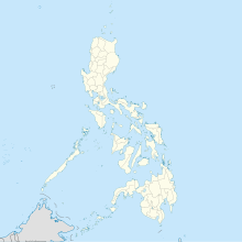
| Map | |||||||||||
| Location in the Philippines | |||||||||||
| Runways | |||||||||||
|
|||||||||||
| Statistics (2016) | |||||||||||
|
|||||||||||
|
Statistics from the Civil Aviation Authority of the Philippines.
|
|||||||||||
Cotabato Airport (Filipino: Paliparan ng Cotabato) (IATA: CBO, ICAO: RPMC) also known as Cotabato City Airport is an airport serving the general area of Cotabato City, located in the province of Maguindanao in the Philippines. It is classified as a Class 1 principal (major domestic) airport by the Civil Aviation Authority of the Philippines, a body of the Department of Transportation and Communications that is responsible for the operations of all airports in the Philippines except the major international ones.
The airport is ranked twenty first (21st) on the busiest airport in the entire Philippines, the airport services generally the people of Cotabato City.
Night Time Flights According to the Department of Transportation (DOTr), airports in the city of Cotabato is now undergoing rehabilitation and expansion.
The repairs include the widening of the breath of the runway and the upgrade of terminal facilities for night-flight capabilities.
International Airport International Airport is proposed to be build to Barangay Tamontaka, Cotabato City, while the existing Domestic Airport will serve as a Military Air Base. as of now the feasibility study is on-going.
...
Wikipedia

