Cossonay
| Cossonay | ||
|---|---|---|

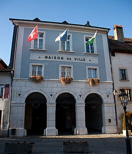
Cossonay town hall
|
||
|
||
| Coordinates: 46°37′N 06°31′E / 46.617°N 6.517°ECoordinates: 46°37′N 06°31′E / 46.617°N 6.517°E | ||
| Country | Switzerland | |
| Canton | Vaud | |
| District | Morges | |
| Government | ||
| • Mayor |
Syndic Georges Rime |
|
| Area | ||
| • Total | 8.29 km2 (3.20 sq mi) | |
| Elevation | 562 m (1,844 ft) | |
| Population (Dec 2015) | ||
| • Total | 3,647 | |
| • Density | 440/km2 (1,100/sq mi) | |
| Postal code | 1304 | |
| SFOS number | 5477 | |
| Localities | Allens | |
| Surrounded by | Penthalaz, Gollion, Senarclens, La Chaux, Dizy, Lussery-Villars | |
| Website |
www Profile (French), SFSO statistics |
|
Cossonay is a municipality in the canton of Vaud in Switzerland. It is part of the district of Morges.
Cossonay has both Roman ruins and medieval graves. The first documentation of the settlement dates from 1096 under the name Cochoniacum. In 1164, this appears as Cosonai, and in 1228 as Cossonai.
Ulrich von Cossonay gave the village church to the monastery in Romainmôtier in 1096. In 1224, it passed to the Benedictine monastery in Lutry, which built a priory in the second half of the 13th century. The town wall, built in the 11th century, was rebuilt and extended in the 13th and 14th centuries. The Barons of Cossonay ruled over a territory from La Chaux to Boussens and from Dizy to Gollion.
Cossonay received city rights in 1264. A fire near the end of the 14th century destroyed much of the town and the town archives. In 1421, the town passed to the house of Savoy.
When the canton of Vaud was conquered by the Bernese in 1536, the town came under the administration at Morges. From 1798 to 1803, Cossonay was part of the canton of Léman in the Helvetic Republic, which was transformed into the canton of Vaud by the mediation of Napoleon. The district of Cossonay was formed in 1798, and the municipality was its capital from its inception to its dissolution.
Cossonay lies at an elevation of 562 m (1,844 ft) and 14 km (8.7 mi) northwest of Lausanne. The town stretches across the high plateau west of the Venoge, about 130 m (430 ft) above the valley floor, in the Gros de Vaud in the middle of the canton of Vaud.
The municipality is the breadbasket of Vaud. The eastern boundary is the Venoge. In the south, it reaches down to the valley of the Valezard, and in the north to Pré Defour. On the west, lies the forest of Sépey, in which the highest point of the municipality lies at an elevation of 620 m. Here lies the Étang du Sépey, which is a lake formed by an earlier quarry.
...
Wikipedia


