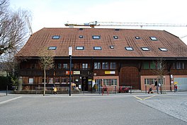
Corminboeuf
| Corminboeuf | ||
|---|---|---|
 |
||
|
||
| Coordinates: 46°48′N 7°6′E / 46.800°N 7.100°ECoordinates: 46°48′N 7°6′E / 46.800°N 7.100°E | ||
| Country | Switzerland | |
| Canton | Fribourg | |
| District | Sarine | |
| Government | ||
| • Mayor | Syndic | |
| Area | ||
| • Total | 7.24 km2 (2.80 sq mi) | |
| Elevation | 633 m (2,077 ft) | |
| Population (Dec 2015) | ||
| • Total | 2,455 | |
| • Density | 340/km2 (880/sq mi) | |
| Postal code | 1720 | |
| SFOS number | 2183 | |
| Surrounded by | Avry, Belfaux, Chésopelloz, Givisiez, Matran, Villars-sur-Glâne | |
| Twin towns | Fussy (France) | |
| Website |
www SFSO statistics |
|
Corminboeuf (Arpitan: ![]() Korminbà ) is a municipality in the district of Sarine in the canton of Fribourg in Switzerland. In 2017 the former municipality of Chésopelloz merged into the municipality of Corminboeuf.
Korminbà ) is a municipality in the district of Sarine in the canton of Fribourg in Switzerland. In 2017 the former municipality of Chésopelloz merged into the municipality of Corminboeuf.
Corminboeuf is first mentioned in 1142 as Cormenbo. In the 15th and 16th centuries it was known as Sankt Görg or St Georg.
After the 2017 merger Corminboeuf had an area of 7.24 km2 (2.80 sq mi).
Before the merger Corminboeuf had an area, (as of the 2004/09 survey) of 5.62 square kilometers (2.17 sq mi). Of this area, about 51.8% is used for agricultural purposes, while 33.3% is forested and 14.9% is settled (buildings or roads). In the 2013/18 survey a total of 72 ha (180 acres) or about 12.9% of the total area was covered with buildings, an increase of 38 ha (94 acres) over the 1981 amount. Over the same time period, the amount of recreational space in the municipality increased by 2 ha (4.9 acres) and is now about 0.89% of the total area. Of the agricultural land, 1 ha (2.5 acres) is used for orchards and vineyards, 273 ha (670 acres) is fields and grasslands. Since 1981 the amount of agricultural land has decreased by 50 ha (120 acres). Over the same time period the amount of forested land has increased by 2 ha (4.9 acres).
The municipality is located in the Sarine district.
The blazon of the municipal coat of arms is Or, St. George armoured Argent cloaked Gules and haired Sable riding a horse of the last harnessed of the third killing a Dragon (wyvern) Vert with a spear of the field.
...
Wikipedia


