Cordillera Real (Bolivia)
| Cordillera Real | |
|---|---|

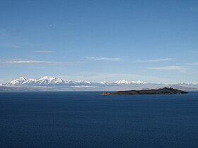
Cordillera Real as seen from Lake Titicaca
|
|
| Highest point | |
| Peak | Illimani |
| Elevation | 21,122 ft (6,438 m) |
| Coordinates | 16°39′14″S 67°47′05″W / 16.65389°S 67.78472°W |
| Dimensions | |
| Length | 125 km (78 mi) |
| Width | 20 km (12 mi) |
| Geography | |
| Country | Bolivia |
| State/Province | Altiplano |
| Range coordinates | 17°00′S 67°10′W / 17°S 67.17°WCoordinates: 17°00′S 67°10′W / 17°S 67.17°W |
| Parent range | Andes |
| Geology | |
| Type of rock | granite |
The Cordillera Real is a mountain range in the South American Altiplano of Bolivia. This range of fold mountains, largely composed of granite, is located southeast of Lake Titicaca, and east of the Bolivian capital of La Paz, measuring 125 km in length and 20 km in width. Despite the fact that it is only 17° south of the Equator, the Cordillera Real is relatively densely glaciated. This is due to its proximity to the Amazon lowlands with its associated moist air masses.
The highest mountain in the range is Illimani at 6,438 metres (21,122 ft). Other notable peaks are:
...
Wikipedia
