Conway, Pennsylvania
| Conway, Pennsylvania | |
|---|---|
| Borough | |

Houses on Second Avenue
|
|
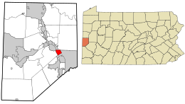
 Location in Beaver County and state of Pennsylvania |
|
| Coordinates: 40°39′48″N 80°14′10″W / 40.66333°N 80.23611°WCoordinates: 40°39′48″N 80°14′10″W / 40.66333°N 80.23611°W | |
| Country | United States |
| State | Pennsylvania |
| County | Beaver |
| Incorporated | 1902 |
| Government | |
| • Type | Borough Council |
| Area | |
| • Total | 1.5 sq mi (4 km2) |
| • Land | 1.2 sq mi (3 km2) |
| • Water | 0.3 sq mi (0.8 km2) |
| Elevation | 909 ft (277 m) |
| Population (2010) | |
| • Total | 2,176 |
| • Density | 1,825.3/sq mi (704.8/km2) |
| Time zone | Eastern (EST) (UTC-5) |
| • Summer (DST) | EDT (UTC-4) |
| Zip code | 15027 |
| Area code(s) | 724 |
Conway is a borough in Beaver County, Pennsylvania, United States, located along the Ohio River. At the 2010 census, the borough had a total population of 2,176.
Conway is located at 40°39′48″N 80°14′10″W / 40.66333°N 80.23611°W (40.663466, -80.235981).
According to the United States Census Bureau, the borough has a total area of 1.5 square miles (3.9 km2), of which, 1.2 square miles (3.1 km2) of it is land and 0.2 square miles (0.52 km2) of it (13.70%) is water.
Conway is the site of Conway Yard, a major railroad classification yard and locomotive facility, owned by Norfolk Southern and inherited from Conrail, originally developed by the Pennsylvania Railroad.
At the census of 2000, there were 2,290 people, 988 households, and 656 families living in the borough. The population density was 707.3/square kilometre; (1,825.3/square mile). There were 1,026 housing units at an average density of 316.9/square kilometre; (817.8/square mile). The racial makeup of the borough was 98.25% White, 1.27% African American, 0.04% Native American, 0.04% from other races, and 0.39% from two or more races. Hispanic or Latino of any race were 0.48% of the population.
...
Wikipedia
