Con Dao Airport
|
Cỏ Ống Airport Sân bay Cỏ Ống |
|||||||||||
|---|---|---|---|---|---|---|---|---|---|---|---|

Con Dao airport
|
|||||||||||
| Summary | |||||||||||
| Airport type | Public | ||||||||||
| Operator | Southern Airports Authority | ||||||||||
| Location | Côn Đảo | ||||||||||
| Elevation AMSL | 20 ft / 6 m | ||||||||||
| Coordinates | 08°43′57″N 106°37′44″E / 8.73250°N 106.62889°ECoordinates: 08°43′57″N 106°37′44″E / 8.73250°N 106.62889°E | ||||||||||
| Website | condaointernational |
||||||||||
| Map | |||||||||||
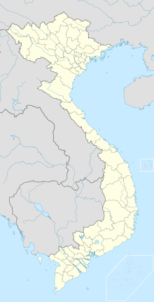
| Location of airport in Vietnam | |||||||||||
| Runways | |||||||||||
|
|||||||||||
Côn Đảo Airport or Cỏ Ống Airport (IATA: VCS, ICAO: VVCS) (Vietnamese: Sân bay Cỏ Ống) is located on Côn Sơn Island, the largest island of Côn Đảo archipelago off the coast of Bà Rịa–Vũng Tàu Province, Vietnam.
...
Wikipedia

