Colrain, Massachusetts
| Colrain, Massachusetts | ||
|---|---|---|
| Town | ||

The Green River, flowing along the Colrain border
|
||
|
||
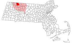
 Location in Franklin County in Massachusetts |
||
| Coordinates: 42°40′23″N 72°41′50″W / 42.67306°N 72.69722°WCoordinates: 42°40′23″N 72°41′50″W / 42.67306°N 72.69722°W | ||
| Country | United States | |
| State | Massachusetts | |
| County | Franklin | |
| Settled | 1735 | |
| Incorporated | 1761 | |
| Government | ||
| • Type | Open town meeting | |
| Area | ||
| • Total | 43.4 sq mi (112.4 km2) | |
| • Land | 43.1 sq mi (111.7 km2) | |
| • Water | 0.3 sq mi (0.7 km2) | |
| Elevation | 633 ft (193 m) | |
| Population (2010) | ||
| • Total | 1,671 | |
| • Density | 39/sq mi (15/km2) | |
| Time zone | Eastern (UTC-5) | |
| • Summer (DST) | Eastern (UTC-4) | |
| ZIP code | 01340 | |
| Area code(s) | 413 | |
| FIPS code | 25-14885 | |
| GNIS feature ID | 0618160 | |
| Website | www |
|
Colrain is a town in Franklin County, Massachusetts, United States. The population was 1,671 at the 2010 census. It is part of the Springfield, Massachusetts Metropolitan Statistical Area.
Colrain was first settled in 1735 as "Boston Township No. 2", organized into an independently governing town body in 1745, and was officially incorporated on June 30, 1761.
Although originally named Colrain in 1745, and officially incorporated under that name in 1761, the town spelled its name (and appeared on maps) as "Colraine" for over 112 years until in 1873 the Commonwealth of Massachusetts insisted that the town begin to spell its name as it was officially incorporated.
Colrain has nine historic village areas: Elm Grove, Lyonsville, Foundry Village, Shattuckville, Griswoldville, Colrain City, Catamount Hill, Stewartville, and Gimletville. Much of the town's land area lies outside of these villages.
Colrain City (which constitutes the town center), was originally named as a joke during the mid 19th-century, since the small village was clearly anything but a city. Located in the valley at the base of Chandler Hill, a contemporary satirical poem suggested that the inexplicable grouping of houses was populated by people who had failed to climb the road leading over the hill. The center has remained almost completely unchanged over the last 150 years, and was declared a historic district in 2006.
In May 1812, Colrain was the first town in the United States to fly the U.S. flag over a public schoolhouse. The schoolhouse was located in the hill-top village of Catamount.
Many of the original settlers were immigrants from Ireland and Scotland, and it is said that the town was named in honor of Lord Coleraine, an Irish peer. According to local tradition, Lord Coleraine was so well pleased by this that he sent a fine bell to the townspeople for their new meeting house. Unfortunately, the bell never arrived. Apparently, so the story goes, it was sold by the unscrupulous agent to whom it was entrusted, and was installed in a church in Boston. An alternative claim is that when in transit, the crew of the ship encountered a problem and the ship went down with the bell and was never to be found again.
...
Wikipedia

