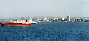
Colón, Panama
| Colón | |||
|---|---|---|---|
| City | |||
| Ciudad de Colón | |||
 |
|||
|
|||
| Coordinates: 9°21′26″N 79°53′55″W / 9.35722°N 79.89861°WCoordinates: 9°21′26″N 79°53′55″W / 9.35722°N 79.89861°W | |||
| Country |
|
||
| Province | Colón Province | ||
| Government | |||
| • President | Juan Carlos Varela | ||
| • Mayor | Federico Policani | ||
| Elevation | 9 m (30 ft) | ||
| Population (2010) | |||
| • City | 78,000 | ||
| • Metro | 241,928 | ||
| Area code(s) | +507 | ||
| Website | |||
Colón (Spanish pronunciation: [koˈlon]) is a Panamanian city and sea port beside the Caribbean Sea, lying near the Atlantic entrance to the Panama Canal. It is the capital of Panama's Colón Province and has traditionally been known as Panama's second city. Originally, it was located entirely on Manzanillo Island, surrounded by Limon Bay, Manzanillo Bay and the Folks River, but, since the disestablishment of the Panama Canal Zone, the city's limits have been redefined to include Fort Gulick, a former U.S. Army base, as well the former Canal Zone towns of Cristobal, Margarita and Coco Solo.
The city was founded by Americans in 1850 as the Atlantic terminal of the Panama Railroad, then under construction to meet the gold rush demand for a fast route to California. For a number of years early in its history, the sizable United States émigré community called the town Aspinwall after Panama Railroad promoter William Henry Aspinwall, while the city's Hispanic community called it Colón in honor of Christopher Columbus. The city was founded on the western end of a treacherously marshy islet known as Manzanillo Island. As part of the construction of the Panama Railroad, the island was connected to the Panamanian mainland by a causeway and part of the island was drained to allow the erection of permanent buildings.
...
Wikipedia


