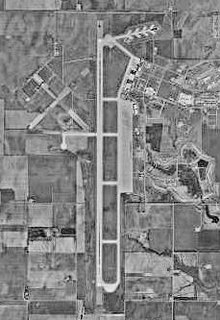
Clinton-Sherman Industrial Airpark
| Clinton-Sherman Industrial Airpark | |||||||||||||||
|---|---|---|---|---|---|---|---|---|---|---|---|---|---|---|---|
 |
|||||||||||||||

Airfield diagram from Federal Aviation Administration
|
|||||||||||||||
| Summary | |||||||||||||||
| Airport type | Public | ||||||||||||||
| Owner | Oklahoma Space Industry Development Authority | ||||||||||||||
| Serves | Clinton, Oklahoma | ||||||||||||||
| Location | Burns Flat, Oklahoma | ||||||||||||||
| Elevation AMSL | 1,922 ft / 586 m | ||||||||||||||
| Runways | |||||||||||||||
|
|||||||||||||||
| Statistics (2006) | |||||||||||||||
|
|||||||||||||||
|
Source: Federal Aviation Administration
|
|||||||||||||||
| Aircraft operations | 49,500 |
|---|
Coordinates: 35°20′23″N 099°12′02″W / 35.33972°N 99.20056°W
The Clinton-Sherman Industrial Airpark, also known as the Oklahoma Air & Space Port is a spaceport near Burns Flat, Oklahoma, in the western part of the state. The Federal Aviation Administration (FAA) granted a license to the site in June 2006 to the Oklahoma Space Industry Development Authority (OSIDA) to "oversee the takeoff and landing of suborbital, reusable launch vehicles". The license expires in five years and requires regular safety inspections by the FAA. Individual operators must also secure a separate license in order to make space flights from the facility.
The airpark is at the site of a public airfield known as Clinton-Sherman Airport (IATA: CSM, ICAO: KCSM). The airport covers an area of 1,690 acres (680 ha) which contains two concrete paved runways: 17R/35L measuring 13,503 x 150 ft (46 m). and 17L/35R measuring 5,193 x 75 ft. (1,583 x 23 m). The longer of these, at 13,503 x 150 ft (4,116 x 46 m) is a major benefit for use as a spaceport.
...
Wikipedia
