Cline Falls State Scenic Viewpoint
| Cline Falls State Scenic Viewpoint | |
|---|---|

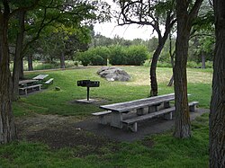
Picnic area at Cline Falls park
|
|
| Type | Public, state |
| Location | Deschutes County, Oregon |
| Nearest city | Redmond |
| Coordinates | 44°16′07″N 121°15′21″W / 44.2687303°N 121.2558687°WCoordinates: 44°16′07″N 121°15′21″W / 44.2687303°N 121.2558687°W |
| Area | 9 acres (3.6 ha) |
| Operated by | Oregon Parks and Recreation Department |
Cline Falls State Scenic Viewpoint (also known as Cline Falls State Park) is a state park near Redmond, Oregon, United States. It is located on the Deschutes River. The park covers 9 acres (36,000 m2). It is administered by the Oregon Parks and Recreation Department.
Cline Falls is located on the Deschutes River approximately four miles west of Redmond, Oregon. The falls were named for Doctor C. A. Cline (1850–1926) a Redmond dentist, who owned the land adjacent to the falls. The falls occur just north of the point where Highway 126 crosses the Deschutes River. In the 1950s, the Oregon Parks and Recreation Department acquired property above Cline Falls for the purpose of creating a day use park.
Cline Falls State Scenic Viewpoint is a day use park that covers 9 acres (36,000 m2) on the east side of the Deschutes River. It is located on the south side of the Highway 126. Because Clines Falls are a short distance north of the highway, the falls are not within the park boundary.
The park has a large open lawn surrounded by ponderosa pine, western juniper, poplar, and locust trees that extend to the river’s edge. The park also includes riparian habitat, sagebrush covered uplands, and canyon rimrocks. These areas are home to blackbirds, canyon wrens, American dipper, song sparrows, and finches. Other song birds pass through the area during the spring and fall migrations. Prairie falcons and golden eagles are also found in the Cline Falls area.
...
Wikipedia

