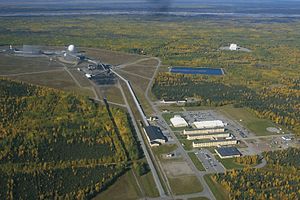
Clear AFS
| Clear Air Force Station | |
|---|---|
| Part of |
|
| Denali Borough, Alaska, United States | |

AN/FPS-123 building (white, upper right) on Clear AFS
|
|
|
Location in Alaska
|
|
| Coordinates | 64°17′26″N 149°11′13″W / 64.29056°N 149.18694°W |
| Site information | |
| Controlled by |
1983: 1st Space Wing (Space Command)
|
| Site history | |
| Built |
|
| Garrison information | |
| Past commanders |
1961: Col. Walter F. Nyblade |
|
|
|
|
|
|
|
|
1983: 1st Space Wing (Space Command)
Clear Air Force Station ("Clear" colloq.) is an Alaska Air National Guard radar station for detecting incoming ICBMs and submarine-launched ballistic missiles to NORAD's Missile Correlation Center (MCC) and to provide Space Surveillance data to Air Force Space Command's Space Control Center (SCC). Clear's AN/FPS-123 Upgraded Early Warning Radar is part of the Solid State Phased Array Radar System (SSPARS) which also includes those at Beale AFB, Cape Cod AFS, RAF Fylingdales and Thule Site J. The "historic property" was one of the Alaska World War II Army Airfields and later a Cold War BMEWS site providing NORAD data to Colorado's BMEWS Central Computer and Display Facility (CC&DF).
In addition to the "original camp area" with buildings still in use today, areas of the station include the airfield (ICAO: PACL), the "SSPARS Site", the technical site (Utilador, BMEWS reflectors, support buildings, power plant), and the composite site (two permanent dormitories, a mess hall, recreation area, and administrative area). In addition to the Air National Guard unit, Clear has active duty USAF, Royal Canadian Air Force, civilian, and contractor personnel.
...
Wikipedia

