Clayton, Delaware
| Clayton, Delaware | |
|---|---|
| Town | |

Entrance to St. Joseph's Industrial School
|
|
| Etymology: John Middleton Clayton | |
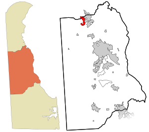
 Location in Kent County and the state of Delaware. |
|
| Location within the state of Delaware | |
| Coordinates: 39°17′26″N 75°38′04″W / 39.29056°N 75.63444°WCoordinates: 39°17′26″N 75°38′04″W / 39.29056°N 75.63444°W | |
| Country | United States |
| State | Delaware |
| County | Kent, New Castle |
| Area | |
| • Total | 1.0 sq mi (3 km2) |
| • Land | 1.0 sq mi (3 km2) |
| • Water | 0.0 sq mi (0 km2) |
| Elevation | 46 ft (14 m) |
| Population (2010) | |
| • Total | 2,918 |
| • Density | 1,242.3/sq mi (479.7/km2) |
| Time zone | Eastern (EST) (UTC-5) |
| • Summer (DST) | EDT (UTC-4) |
| ZIP code | 19938 |
| Area code(s) | 302 |
| GNIS feature ID | 213805 |
Clayton is a town in Kent and New Castle counties in the U.S. state of Delaware. Located almost entirely in Kent County, it is part of the Dover, Delaware Metropolitan Statistical Area. The population was 2,918 at the 2010 census.
Byrd's AME Church, the Clayton Railroad Station, Enoch Jones House, and St. Joseph's Industrial School are listed on the National Register of Historic Places.
Clayton is located at 39°17′26″N 75°38′04″W / 39.29056°N 75.63444°W (39.2906671, -75.6343727).
According to the United States Census Bureau, the town has a total area of 1.0 square mile (2.6 km2), all land. It was named after John Middleton Clayton a prominent 19th-century Delaware lawyer and politician.
As of the census of 2000, there were 1,273 people, 499 households, and 346 families residing in the town. The population density was 1,242.3 people per square mile (481.9/km²). There were 524 housing units at an average density of 511.4 per square mile (198.4/km²). The racial makeup of the town was 90.26% White, 8.09% African American, 0.31% Native American, 0.08% Asian, 0.08% Pacific Islander, 0.47% from other races, and 0.71% from two or more races. Hispanic or Latino of any race were 1.34% of the population.
...
Wikipedia


