Clarborough
| Clarborough | |
|---|---|
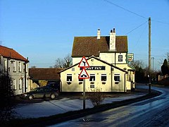
 Public house in Clarborough |
|
| Clarborough shown within Nottinghamshire | |
| Population | 1,088 (2011) |
| OS grid reference | SK731832 |
| • London | 130 mi (210 km) S |
| Civil parish |
|
| District |
|
| Shire county | |
| Region | |
| Country | England |
| Sovereign state | United Kingdom |
| Post town | Retford |
| Postcode district | DN22 |
| Police | Nottinghamshire |
| Fire | Nottinghamshire |
| Ambulance | East Midlands |
| EU Parliament | East Midlands |
Clarborough is a village in the civil parish of Clarborough and Welham, in the district of Bassetlaw, Nottinghamshire, England. Clarborough is located 2 miles (3 km) north-east from the centre of Retford. The population of the civil parish as taken at the 2011 Census was 1,088.
Clarborough is listed in the 1086 Domesday Book as "Claueburch" or "Claureburg." The chief value of the village was its land. Because of the village's geographical position, being at the foot of Clarborough Hill, land was useful for agriculture, including grazing. By 1769 Clarborough was written on maps as "Charlborough".
A post windmill was located on Clarborough Hill. It was standing in 1753, but burnt down in 1896.
During the period of the late 19th century, the 1881 Census provided information on the occupation classification of the inhabitants of Clarborough. This data helps to give an insight of the history of the area. The central field of employment for males during this era was in agriculture, with 667 males working within this field. Although a great number (145) were employed within the field entitled 'Wrks in Var. Mineral Substances', this could be explained through the location of Clarborough being in the Midlands, and during this time miners were in great demand, due to the volume of demand. The number of males employed within the 'professionals' field was significantly lower, standing at only 28.
The 1881 Census also provided information on the female occupations, with the majority (889) being categorised with an 'Unknown Occupation'. This may be seen as stereotypical for this era as it would primarily be the males in the family who earned the living. Nevertheless, this data also provides evidence stating that 385 females worked within the 'Domestic Services or Offices' grouping. Although, this is quite a minor percentage of the population of the population at this time as the 1881 Census states the population of Clarborough to be 6,290.
The village of Clarborough may have been classified with a lower class status due to the occupations found, with the vast majority of the village working in a primary field, rather than tertiary such as the level of 'Professionals' found was significantly lower compared to those working in 'Agriculture'.
As transport links improved and personal transport became the norm, Clarborough developed through the latter part of the 20th century with major employment opportunities developing at local power stations as well as public sector employers such as education, police and prison service. Improvements to the railway network, particularly the East Coast Main Line through Retford that links Edinburgh and Leeds with London, also increased property prices as commuting became more feasible.
...
Wikipedia

