City College (Sacramento RT)
|
City College
|
|||||||||||
|---|---|---|---|---|---|---|---|---|---|---|---|
| Sacramento RT light rail station | |||||||||||

Platform, September 13, 2007
|
|||||||||||
| Location | 24th Street Sacramento, CA |
||||||||||
| Coordinates | 38°32′30.69″N 121°29′7.22″W / 38.5418583°N 121.4853389°WCoordinates: 38°32′30.69″N 121°29′7.22″W / 38.5418583°N 121.4853389°W | ||||||||||
| Owned by | Sacramento RT | ||||||||||
| Line(s) |
Sacramento Regional Transit District (Sacramento RT): |
||||||||||
| Platforms | 2 side platforms | ||||||||||
| Construction | |||||||||||
| Structure type | at-grade | ||||||||||
| Disabled access | Yes | ||||||||||
| History | |||||||||||
| Opened | September 26, 2003 | ||||||||||
| Services | |||||||||||
|
|||||||||||
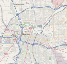
| Location | |||||||||||
Sacramento Regional Transit District (Sacramento RT):
City College is a side platformed Sacramento RT light rail station on the Sacramento City College campus in Sacramento, California, United States. The station was opened on September 26, 2003, and is operated by the Sacramento Regional Transit District. As part of the Blue Line, it has service to Downtown Sacramento, North Sacramento, California State University, Sacramento, Rancho Cordova, Gold River and Folsom.
The station is located northeast of Charles C. Hughes Stadium on campus. In addition to serving the college this station also serves William Land Park and Curtis Park. This 60-foot (18 m) wide station provides bus service, drop-off areas, and walkways to the stadium, campus, and parking lots.
...
Wikipedia

