Christchurch Airport
| Christchurch International Airport | |||||||||||||||||||
|---|---|---|---|---|---|---|---|---|---|---|---|---|---|---|---|---|---|---|---|
 |
|||||||||||||||||||

Aerial view of the airport
|
|||||||||||||||||||
| Summary | |||||||||||||||||||
| Airport type | Public/Military | ||||||||||||||||||
| Owner | Christchurch City Council (75%) NZ Government (25%) |
||||||||||||||||||
| Operator | Christchurch International Airport Limited | ||||||||||||||||||
| Serves | Christchurch | ||||||||||||||||||
| Location | Harewood, Christchurch | ||||||||||||||||||
| Hub for | Air New Zealand | ||||||||||||||||||
| Elevation AMSL | 37 m / 123 ft | ||||||||||||||||||
| Coordinates | 43°29′22″S 172°31′56″E / 43.48944°S 172.53222°ECoordinates: 43°29′22″S 172°31′56″E / 43.48944°S 172.53222°E | ||||||||||||||||||
| Website | www.christchurchairport.co.nz | ||||||||||||||||||
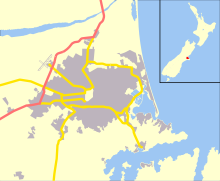
| Map | |||||||||||||||||||
| Location of the airport in Christchurch | |||||||||||||||||||
| Runways | |||||||||||||||||||
|
|||||||||||||||||||
| Helipads | |||||||||||||||||||
|
|||||||||||||||||||
| Statistics (January 2016 to December 2016) | |||||||||||||||||||
|
|||||||||||||||||||
| Passengers (Total) | 6,439,703 |
|---|---|
| Movements | 94,955 |
Christchurch International Airport (IATA: CHC, ICAO: NZCH) is the main airport that serves Christchurch, New Zealand. It is located 12 kilometres to the northwest of the city centre, in the suburb of Harewood. Christchurch (Harewood) Airport officially opened on 18 May 1940 and became New Zealand's first international airport on 16 December 1950. It is the second busiest airport in New Zealand after Auckland by both annual passengers and aircraft movements. Christchurch along with Auckland are the only two airports in New Zealand to regularly handle Boeing 747 and Airbus A380 aircraft. The airport is curfew free operating 24 hours a day.
The prevailing wind in Christchurch is from the north-east and to a lesser extent from the south-west, but the city is also affected by Canterbury's nor'wester foehn wind. As a result, the airport has two perpendicular runways: a 3288 m primary runway (02/20) orientated with the north-easterly and south-westerly prevailing winds, and a 1741 m secondary runway (11/29) orientated for use during nor'westers. The airport also has a third grass runway, parallel to the primary runway, for use by general aviation.
Due to increasing passenger numbers, the airport has completed construction of a major terminal upgrade. The new construction's primary wing opened in 2011 and the upgrade was completed in 2013.
In 1935 a decision was made by the local council to locate a new aerodrome at Harewood as the best site for Christchurch. Development of the aerodrome at Harewood commenced in 1936 when 227 hectares of land was purchased. In 1937 a 915-metre runway and a 60 square metre terminal were constructed. In 1940 the airport became RNZAF Station Harewood. By 1946 the form of the terminal area development was established with hangars, a small terminal building, the water tower and some barracks buildings. In 1950 Christchurch Airport received clearance for international operations from the government. The two runways and parallel taxiway concept was established in 1953—runway 02/20 at 2.012 metres and 11/29 at 1,741m. In 1954 TEAL introduced Douglas DC-6 aircraft to its trans-Tasman services. In February 1960 a new terminal building, designed by architect Paul Pascoe, was brought into operation.
...
Wikipedia

