Chitrakoot, Madhya Pradesh
|
Chitrakoot चित्रकूट Chitrakoot |
|
|---|---|
| city | |

View of Ramghat at Chitrakoot
|
|
| Coordinates: 25°00′N 80°50′E / 25.00°N 80.83°ECoordinates: 25°00′N 80°50′E / 25.00°N 80.83°E | |
| Country | India |
| State | Madhya Pradesh |
| District | Satna |
| Population (2001) | |
| • Total | 22,294 |
| Languages | |
| • Official | Hindi |
| Time zone | IST (UTC+5:30) |
| ISO 3166 code | IN-MP |
| Vehicle registration | MP |
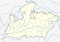
Chitrakoot (Hindi: चित्रकूट) is a town and a nagar panchayat in the Satna district in the state of Madhya Pradesh, India. It is a town of religious, cultural, historical and archaeological importance, situated in the Baghelkhand region. It borders the Chitrakoot district in Uttar Pradesh, whose headquarters Chitrakoot Dham (Karwi) is located nearby. The town lies in the historical Chitrakoot region, which is divided between the present-day Indian states of Madhya Pradesh and Uttar Pradesh. It is known for a number of temples and sites mentioned in Hindu scriptures.
Many people gather here on each Amavasya. Somwati Amavasyas, Deepawali, Sharad-Poornima, Makar Sankranti and Ramanavami are special occasions for such gatherings and celebrations. It attracts crowds throughout the year including above occasions and for Free Eye Hospital Camps. Noted 'Ayurvedic' and 'Yoga' centres like 'Arogyadham' are located in Chitrakoot.
Chitrakoot means the 'Hill of many wonders'. Chitrakoot falls in the northern Vindhya range of mountains spread over the states of Uttar Pradesh and Madhya Pradesh. The Chitrakuta region is included in the District Chitrakuta of Uttar Pradesh and the District Satna of Madhya Pradesh. Chitrakoot district in Uttar Pradesh was created on 4 September 1998.
Chitrakoot Parvat Mala includes Kamad Giri, Hanumaan Dhara, Janki Kund, Lakshman pahari, and Devangana famous Religious mountains.
...
Wikipedia

