Chiang Kham
|
Chiang Kham เชียงคำ |
|
|---|---|
| Amphoe | |
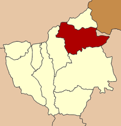
 Amphoe location in Phayao Province |
|
| Coordinates: 19°31′24″N 100°18′6″E / 19.52333°N 100.30167°ECoordinates: 19°31′24″N 100°18′6″E / 19.52333°N 100.30167°E | |
| Country | Thailand |
| Province | Phayao |
| Tambon | 10 |
| Muban | 135 |
| Area | |
| • Total | 784.061 km2 (302.728 sq mi) |
| Population (2015) | |
| • Total | 77,194 |
| • Density | 98.5/km2 (255/sq mi) |
| Time zone | ICT (UTC+7) |
| Postal code | 56110 |
| Geocode | 5603 |
Chiang Kham (Thai: เชียงคำ, pronounced [t͡ɕʰīa̯ŋ kʰām]) is a district (amphoe) in the northeastern part of Phayao Province, northern Thailand.
Neighboring districts are (from the south clockwise) Pong, Chun of Phayao Province, Thoeng of Chiang Rai Province and Phu Sang of Phayao Province again. To the northeast is Xaignabouli Province of Laos.
The Chiang Kham District is divided into 10 sub-districts (Tambon), which are further subdivided into 135 administrative villages (Muban).
There are four sub-district municipalities (Thesaban Tambon) in the district:
There are seven sub-district administrative organizations (SAO) in the district:
...
Wikipedia
