Chexbres
| Chexbres | ||
|---|---|---|
 |
||
|
||
| Coordinates: 46°29′N 6°46′E / 46.483°N 6.767°ECoordinates: 46°29′N 6°46′E / 46.483°N 6.767°E | ||
| Country | Switzerland | |
| Canton | Vaud | |
| District | Lavaux | |
| Government | ||
| • Mayor | Jean-Michel Conne | |
| Area | ||
| • Total | 2.14 km2 (0.83 sq mi) | |
| Elevation | 589 m (1,932 ft) | |
| Population (Dec 2015) | ||
| • Total | 2,216 | |
| • Density | 1,000/km2 (2,700/sq mi) | |
| Demonym(s) | Les Chexbriens | |
| Postal code | 1071 | |
| SFOS number | 5601 | |
| Surrounded by | Puidoux, Rivaz, Saint-Saphorin (Lavaux) | |
| Website |
www Profile (French), SFSO statistics |
|
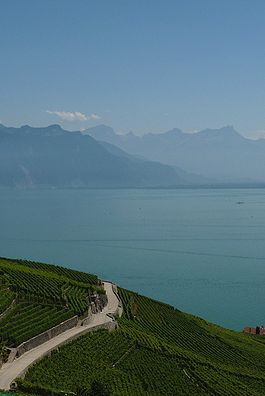
Chexbres is a municipality in the Swiss canton Vaud, located in the district of Lavaux-Oron. Chexbres is a wine-growing village and enjoys a good selection of local vintages. It also enjoys notable views of Lake Geneva, and therefore is nicknamed "Balcon du Léman" in French.
The municipality of Chexbres was already inhabited in Roman times, and a single wall remains and coins have been found. The first written mention of the place appeared in 1139 under the name Chexbres. In the ensuing period many other names: Chibriacum (1100), Chabris (1134), Chabre (1142), Cabarissa (1145), Cerbre (1147), Chebra (1165), Chabrii (1179), Chabre (1221), Chaibri (1248), Chaibry (1368), Chebry (1453), Cheibri (1454) and even to 1562, both Chaybres and Cheybres appeared. The origin of the name is not clearly understood. It could be derived from the Roman personal names Cabrius, from the Gallic words Caebre (meaning city on a hill) or from Cabus (hemp).
The area around Chexbres was owned from the 6th century by the abbey of Saint Maurice and in 978 came under the Kingdom of Burgundy. In 1079 King Henry IV gave the village and lands to the bishop of Lausanne.
With the conquest of Vaud by Bern in 1536, Chexbres came under the administration of the Bailiwick of Lausanne. After the collapse of the ancien régime, the village belonged from 1798 to 1803 during the Helvetic Republic to the Canton of Léman,and later the Canton of Vaud. In 1798 the village was assigned to the district of Lavaux and until 1810 was part of the greater community of Saint-Saphorin within this district. It was only after 1810 that it became a politically independent municipality. Thanks to its scenic location, the village developed during the 19th century into a resort.
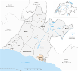
Chexbres is located at 565 m (1,854 ft) above sea level, 12 km (7.5 mi) east-southeast of the capital of the canton of Lausanne (as the crow flies). The village covers an area east of the Forestay river, in Lavaux, a scenic location about 200 m (660 ft) above the lake level of Lake Geneva.
The community itself has no direct lake access, but extends to the east of the Château de Rivaz Glérolles almost to the shores of Lake Geneva. Crêt Bérard at 715 m (2,346 ft) above sea level is the highest point of Chexbres. To the west, the area extends beyond the valleys of the Forestay on the hill of Le Signal at up to 640 m (2,100 ft) above sea level.
...
Wikipedia


