Chester Hill, Pennsylvania
| Chester Hill, Pennsylvania | |
|---|---|
| Borough | |
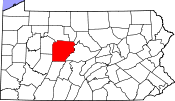
 Map showing Chester Hill in Clearfield County |
|
 Map showing Clearfield County in Pennsylvania |
|
| Pennsylvania | |
| Coordinates: 40°53′30″N 78°13′44″W / 40.89167°N 78.22889°WCoordinates: 40°53′30″N 78°13′44″W / 40.89167°N 78.22889°W | |
| Country | United States |
| State | Pennsylvania |
| County | Clearfield |
| Settled | 1849 |
| Incorporated | 1883 |
| Government | |
| • Type | Borough Council |
| Area | |
| • Total | 0.47 sq mi (1.23 km2) |
| • Land | 0.44 sq mi (1.14 km2) |
| • Water | 0.03 sq mi (0.09 km2) |
| Elevation | 1,450 ft (440 m) |
| Population (2010) | |
| • Total | 883 |
| • Density | 2,012/sq mi (776.8/km2) |
| Time zone | Eastern (EST) (UTC-5) |
| • Summer (DST) | EDT (UTC-4) |
| Area code(s) | 814 |
Chester Hill is a borough in Clearfield County, Pennsylvania, United States. The population was 883 at the 2010 census.
Chester Hill is located in eastern Clearfield County at 40°53′30″N 78°13′44″W / 40.89167°N 78.22889°W (40.891595, -78.228778), on the west side of Moshannon Creek, across from the borough of Philipsburg in Centre County. Pennsylvania Route 53 passes through the borough, leading northeast into Philipsburg and southwest 3.7 miles (6.0 km) to Osceola Mills.
According to the United States Census Bureau, Chester Hill has a total area of 0.47 square miles (1.23 km2), of which 0.44 square miles (1.14 km2) is land and 0.03 square miles (0.09 km2), or 7.30%, is water.
As of the census of 2010, there were 883 people, 382 households, and 250 families residing in the borough. The population density was 1,782.0 people per square mile (688.1/km²). There were 410 housing units at an average density of 827.4 per square mile (319.5/km²). The racial makeup of the borough was 96.9% White, 0.6% Black or African American, 0.9% Asian, 0.2% other, and 1.4% from two or more races. Hispanic or Latino of any race were 0.6% of the population.
...
Wikipedia

