Chesham and Amersham
| Chesham and Amersham | |
|---|---|
|
County constituency for the House of Commons |
|

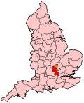
Boundary of Chesham and Amersham in Buckinghamshire.
|
|

Location of Buckinghamshire within England.
|
|
| County | Buckinghamshire |
| Population | 92,635 (2011 census) |
| Electorate | 70,723 (December 2010) |
| Major settlements | Chesham and Amersham |
| Current constituency | |
| Created | 1974 |
| Member of parliament | Cheryl Gillan (Conservative) |
| Number of members | One |
| Created from | South Buckinghamshire |
| Overlaps | |
| European Parliament constituency | South East England |
Coordinates: 51°41′38″N 0°36′36″W / 51.694°N 0.610°W
Chesham and Amersham /ˈtʃɛʃəm ənd ˈæmˌəʃəm/ is a parliamentary constituency represented in the House of Commons of the U.K. Parliament that elects a Member of Parliament (MP). It has to date been a safe Conservative seat.
1974-1983: The Urban District of Chesham, and the Rural District of Amersham.
1983-1997: The District of Chiltern wards of Amersham Common, Amersham-on-the-Hill, Amersham Town, Asheridge Vale, Ashley Green and Latimer, Austenwood, Chalfont Common, Chalfont St Giles, Chalfont St Peter Central, Chartridge, Chenies, Chesham Bois and Weedon Hill, Cholesbury and The Lee, Coleshill and Penn Street, Gold Hill, Hilltop, Holmer Green, Little Chalfont, Little Missenden, Lowndes, Newtown, Penn, Pond Park, St Mary's, Seer Green and Jordans, Townsend, and Waterside, and the District of Wycombe wards of Hazlemere North and Hazlemere South.
...
Wikipedia
