Cherokee Landing State Park
| Cherokee Landing State Park | |
|---|---|
| Location | Cherokee County, Oklahoma, United States |
| Nearest city | Park Hill, OK |
| Coordinates | 35°45′32″N 94°54′32″W / 35.7589808°N 94.9088409°WCoordinates: 35°45′32″N 94°54′32″W / 35.7589808°N 94.9088409°W |
| Area | 146 acres (59 ha) |
| Governing body | Oklahoma Tourism and Recreation Department |
| www |
|
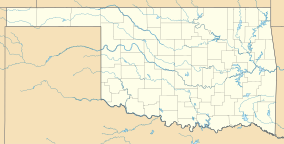
Cherokee Landing State Park is a 146-acre (0.59 km2) Oklahoma state park located in Cherokee County, Oklahoma. It is located near Park Hill, Oklahoma on a peninsula jutting into Lake Tenkiller in the Cookson Hills, south of Tahlequah. The park features 93 RV campsites with electric power and water hookups, dump station, 45 primitive campsites, covered picnic shelters, restrooms with hot showers, boating, lighted boat ramp, water skiing, swimming beach, fishing, handicapped fishing dock, playgrounds and a softball field.
The park is open seven days per week from 7:30 A.M. to 4:00 P.M., though the office is staffed by a volunteer only Wednesday through Saturday 9:00 A.M. through 2:00 P.M.
Hunting is not allowed in the park, but there is a 2,950 acres (11.9 km2) area west of the park boundary that is a state game management and hunting area. This area is under the jurisdiction of the Oklahoma Department of Wildlife Conservation. Hunting is allowed there. Popular game species for hunting are :deer, quail, dove, duck, geese, rabbit and squirrel.
The main road into the parks and the boat ramps is open year round. Wildcat Point is closed November 1 to April 1. All other restrooms and campgrounds are closed from December 1 until March 1.
...
Wikipedia

