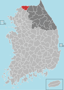
Cheorwon
|
Cheorwon 철원군 |
||
|---|---|---|
| County | ||
| Korean transcription(s) | ||
| • Hangul | ||
| • Hanja | ||
| • Revised Romanization | Cheorwon-gun | |
| • McCune-Reischauer | Ch'ŏrwŏn-gun | |
|
||
 Location in South Korea |
||
| Country |
|
|
| Region | Gwandong, Gyeonggi (before 1434) | |
| Administrative divisions | 4 eup, 3 myeon | |
| Area | ||
| • Total | 899.82 km2 (347.42 sq mi) | |
| Population (2001) | ||
| • Total | 54,040 | |
| • Density | 60.05/km2 (155.5/sq mi) | |
| • Dialect | Gangwon | |
| Cheorwon, South Korea | ||||||||||||||||||||||||||||||||||||||||||||||||||||||||||||
|---|---|---|---|---|---|---|---|---|---|---|---|---|---|---|---|---|---|---|---|---|---|---|---|---|---|---|---|---|---|---|---|---|---|---|---|---|---|---|---|---|---|---|---|---|---|---|---|---|---|---|---|---|---|---|---|---|---|---|---|---|
| Climate chart () | ||||||||||||||||||||||||||||||||||||||||||||||||||||||||||||
|
||||||||||||||||||||||||||||||||||||||||||||||||||||||||||||
|
||||||||||||||||||||||||||||||||||||||||||||||||||||||||||||
| J | F | M | A | M | J | J | A | S | O | N | D |
|
21
1
−11
|
26
4
−8
|
40
10
−3
|
64
18
3
|
102
23
10
|
138
26
16
|
401
28
20
|
338
29
20
|
149
25
14
|
45
19
5
|
46
10
−1
|
21
3
−8
|
| Average max. and min. temperatures in °C | |||||||||||
| Precipitation totals in mm | |||||||||||
| Imperial conversion | |||||||||||
|---|---|---|---|---|---|---|---|---|---|---|---|
| J | F | M | A | M | J | J | A | S | O | N | D |
|
0.8
34
12
|
1
39
18
|
1.6
50
27
|
2.5
64
37
|
4
73
50
|
5.4
79
61
|
16
82
68
|
13
84
68
|
5.9
77
57
|
1.8
66
41
|
1.8
50
30
|
0.8
37
18
|
| Average max. and min. temperatures in °F | |||||||||||
| Precipitation totals in inches | |||||||||||
...
Wikipedia

