Chelmer and Blackwater Navigation
| Chelmer and Blackwater Navigation | |
|---|---|

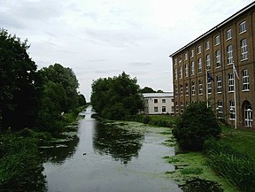
The Navigation from Colchester Road, Maldon
|
|
| Specifications | |
| Length | 13.75 miles (22.13 km) |
| Maximum boat length | 60 ft 0 in (18.29 m) |
| Maximum boat beam | 16 ft 0 in (4.88 m) |
| Locks | 12 |
| Status | Navigable |
| Navigation authority | Essex Waterways |
| History | |
| Original owner | Chelmer and Blackwater Navigation Co |
| Principal engineer | John Rennie |
| Other engineer(s) | Richard Coates |
| Date of act | 1793 |
| Date completed | 1797 |
| Geography | |
| Start point | Chelmsford |
| End point | Heybridge, Maldon |
| Connects to | Blackwater estuary |
The Chelmer and Blackwater Navigation is the canalisation of the Rivers Chelmer and Blackwater in Essex, in the east of England. The navigation runs for 13.75 miles (22.13 km) from Springfield Basin in Chelmsford to the sea lock at Heybridge Basin near Maldon. It was opened in 1797, and remained under the control of the original company until 2003. It is now run by Essex Waterways Ltd, a wholly owned subsidiary of the Inland Waterways Association.
The navigation runs from Springfield Basin in Chelmsford to the sea lock at Heybridge Basin near Maldon. It has six bridges and drops 75 feet (23 m) through 12 locks from the basin to the sea. There is also a set of flood gates at Beeleigh, which prevents water from the River Blackwater flooding the cut to Heybridge Basin. The navigation meanders in a broadly west to east direction between Chelmsford and Maldon, through countryside which is largely arable, and although it passes near to a number of villages, all of them are set back some distance from the waterway.
Prior to the actual construction of the navigation, there had been almost 120 years of proposals for such a scheme, and opposition from the port of Maldon, which anticipated that its revenues would fall if vessels could travel to Chelmsford. The first such scheme was proposed in 1677 by Andrew Yarranton, who published his idea in a work entitled England's Improvements by Sea and Land. Maldon objected and the scheme came to nothing. In July 1733, John Hore, who was involved in the Kennet, Stroudwater, and the Avon Navigation at Bristol, proposed two schemes, one to make the river navigable, and another to create a new cut between Chelmsford and Maldon. Despite the projected extra costs for a canal, Hore favoured the canal scheme, as he believed there would be less objection from the millers along the river route. Maldon again objected on commercial grounds, and the scheme was dropped.
...
Wikipedia
