Charnwood (UK Parliament constituency)
| Charnwood | |
|---|---|
|
County constituency for the House of Commons |
|

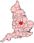
Boundary of Charnwood in Leicestershire.
|
|

Location of Leicestershire within England.
|
|
| County | Leicestershire |
| Population | 94,748 (2011 census) |
| Electorate | 75,454 (December 2010) |
| Major settlements |
Anstey, Birstall, East Goscote, Queniborough, Rothley, Syston, Thurmaston, Woodhouse Eaves, Glenfield, Kirby Muxloe, Leicester Forest East, Groby |
| Current constituency | |
| Created | 1997 |
| Member of parliament | Ed Argar (Conservative) |
| Number of members | One |
| Created from | Loughborough, Rutland and Melton, Blaby, Bosworth |
| Overlaps | |
| European Parliament constituency | East Midlands |
Charnwood is a constituency represented in the House of Commons of the UK Parliament since 2015 by Ed Argar of the Conservative Party.
The seat emerged from the Boundary Commission report of 1995 reflecting population increases in Leicestershire for the 1997 general election; the largest part of it was previously in Loughborough. To date Charnwood has been a Conservative Party stronghold.
1997–2010: The Borough of Charnwood wards of Birstall Goscote, Birstall Greengate, Birstall Netherhall, Birstall Riverside, Birstall Stonehill, Bradgate, East Goscote, Mountsorrel and Rothley, Queniborough, Six Hills, Syston, Thurcaston, Thurmaston, and Woodhouse and Swithland, the District of Blaby wards of Ellis, Fairestone, Kirby, and Leicester Forest East, and the Borough of Hinckley and Bosworth wards of Groby and Ratby.
2010–present: The Borough of Charnwood wards of Anstey, Birstall Wanlip, Birstall Watermead, East Goscote, Forest Bradgate, Mountsorrel, Queniborough, Rothley and Thurcaston, Syston East, Syston West, Thurmaston, and Wreake Villages, the District of Blaby wards of Ellis, Fairestone, Forest, and Muxloe, and the Borough of Hinckley and Bosworth ward of Groby.
The seat is close to Leicester, between the city and Nottingham, and covers slightly more than half of the local government district of Charnwood to the north of Leicester. The town of Loughborough is the largest in the borough, but lies in a separate constituency.
Coordinates: 52°42′N 1°12′W / 52.7°N 1.2°W
...
Wikipedia
