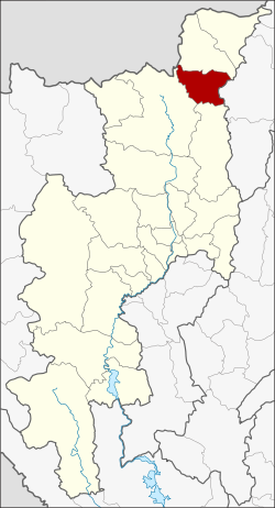
Chai Prakan District
|
Chai Prakan ไชยปราการ |
|
|---|---|
| Amphoe | |
 Amphoe location in Chiang Mai Province |
|
| Coordinates: 19°43′56″N 99°8′25″E / 19.73222°N 99.14028°ECoordinates: 19°43′56″N 99°8′25″E / 19.73222°N 99.14028°E | |
| Country |
|
| Province | Chiang Mai |
| Seat | Pong Tam |
| Area | |
| • Total | 510.9 km2 (197.3 sq mi) |
| Population (2014) | |
| • Total | 44,760 |
| • Density | 93.8/km2 (243/sq mi) |
| Time zone | ICT (UTC+7) |
| Postal code | 50320 |
| Geocode | 5021 |
Chai Prakan (Thai: ไชยปราการ - sometimes transcribed as "Chaiprakan" ) is a district (amphoe) in the northern part of Chiang Mai Province in northern Thailand.
Neighbouring districts are (from the south clockwise) Phrao, Chiang Dao, Fang of Chiang Mai Province and Mae Suai of Chiang Rai Province.
The Khun Tan Range stretches from north to south along the eastern side of the district. The western tip of the district lies within the Daen Lao Range.
The minor district (King Amphoe) Chai Prakarn was created on January 1, 1988, when four tambon were split off from Fang district. It was upgraded to a full district on July 4, 1994.
The district Chai Prakan is subdivided into four subdistricts (Tambon), which are further subdivided into 44 administrative villages (Muban).
There are two subdistrict municipalities (Thesaban Tambon) in the district:
There are two subdistrict administrative organizations (SAO) in the district:
...
Wikipedia
