Cerentino
| Cerentino | ||
|---|---|---|

Cerentino village
|
||
|
||
| Coordinates: 46°18′N 8°32′E / 46.300°N 8.533°ECoordinates: 46°18′N 8°32′E / 46.300°N 8.533°E | ||
| Country | Switzerland | |
| Canton | Ticino | |
| District | Vallemaggia | |
| Government | ||
| • Mayor | Sindaco | |
| Area | ||
| • Total | 20.07 km2 (7.75 sq mi) | |
| Elevation | 981 m (3,219 ft) | |
| Population (Dec 2015) | ||
| • Total | 53 | |
| • Density | 2.6/km2 (6.8/sq mi) | |
| Postal code | 6683 | |
| SFOS number | 5309 | |
| Surrounded by | Bosco/Gurin, Campo (Vallemaggia), Cevio, Linescio | |
| Website |
www SFSO statistics |
|
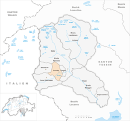
Cerentino is a municipality in the district of Vallemaggia in the canton of Ticino in Switzerland.
During the mid-19th Century, the population declined sharply due to emigration to other countries and a rural exodus. The parish church of Madonna delle Grazie was already in operation in the 15th Century. It was expanded in the beginning of the 16th Century. In 1513, it broke away from the parish of Cevio. The church contains frescoes and stucco from the 17th century.
The soil around Cerentino is rich in limestone, which was used in construction and in the production of lime for mortar. The villages are threatened by landslides and continual erosion.
Modernly, animal husbandry and agriculture, which earlier granted the villages a far-reaching self-sufficiency, is still main income source of most residents. In the summer months there is some tourism to the municipality.
Cerentino has an area, as of 1997[update], of 20.07 square kilometers (7.75 sq mi). Of this area, 0.38 km2 (0.15 sq mi) or 1.9% is used for agricultural purposes, while 13.32 km2 (5.14 sq mi) or 66.4% is forested. Of the rest of the land, 0.36 km2 (0.14 sq mi) or 1.8% is settled (buildings or roads), 0.25 km2 (0.097 sq mi) or 1.2% is either rivers or lakes and 5.31 km2 (2.05 sq mi) or 26.5% is unproductive land.
Of the built up area, housing and buildings made up 0.3% and transportation infrastructure made up 0.8%. Out of the forested land, 54.0% of the total land area is heavily forested and 6.6% is covered with orchards or small clusters of trees. Of the agricultural land, 1.6% is used for growing crops. All the water in the municipality is flowing water. Of the unproductive areas, 17.0% is unproductive vegetation and 9.5% is too rocky for vegetation.
The municipality is located in the Vallemaggia district, at the confluence of the Rovana river with the stream of the Valle di Bosco. It consists of nine inhabited settlements as well as two abandoned ones. The settlements are quite isolated from each other and the rest of the canton. The main settlement is located at an elevation of 979 m (3,212 ft).
...
Wikipedia


