Centralhatchee, Georgia
| Centralhatchee, Georgia | |
|---|---|
| Town | |

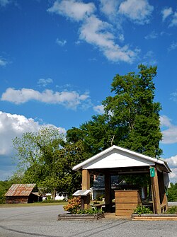
Centralhatchee in 2012
|
|
 Location in Heard County and the state of Georgia |
|
| Coordinates: 33°22′7″N 85°6′15″W / 33.36861°N 85.10417°WCoordinates: 33°22′7″N 85°6′15″W / 33.36861°N 85.10417°W | |
| Country | United States |
| State | Georgia |
| County | Heard |
| Government | |
| • Mayor | Barbie Crockett |
| Area | |
| • Total | 3.3 sq mi (8.5 km2) |
| • Land | 3.3 sq mi (8.5 km2) |
| • Water | 0 sq mi (0 km2) |
| Elevation | 846 ft (258 m) |
| Population (2000) | |
| • Total | 383 |
| • Density | 116.1/sq mi (45.1/km2) |
| Time zone | Eastern (EST) (UTC-5) |
| • Summer (DST) | EDT (UTC-4) |
| FIPS code | 13-15026 |
| GNIS feature ID | 0355098 |
Centralhatchee is a small town in Heard County, Georgia, United States. The population was 383 at the 2000 census.
The town of Centralhatchee was originally a militia district known as "Black Ankle". The community of Glenloch, to the north, was known as "Blue Shin". The geographic configuration of these two communities, according to Indian legend, resembled the ankle and shin portion of the leg and foot. The town became part of Heard County when the county was formed from parts of Carroll, Troup and Coweta Counties in 1830.
The town was chartered in 1903 with the name "Centralhatchee". J.B. Wood was elected as the first mayor.
The Centralhatchee Baptist Church was organized in 1837 with 37 original members. The present building was built in 1896 on land given by Mr. Thomas Vaughn. The first pastor was Rev. William Daniel.
In 1907 the Centralhatchee Methodist Church was organized with Rev. R.F. Hodnett as the pastor.
From 1990 until 2004, Eley Loftin served as mayor of Centralhatchee; he now serves as a city councilman. Today, Barbie Crockett holds the mayoral position.
Centralhatchee is located at 33°22′7″N 85°6′15″W / 33.36861°N 85.10417°W (33.368476, -85.104182).
According to the United States Census Bureau, the town has a total area of 3.3 square miles (8.5 km2), all land.
As of the census of 2000, there were 383 people, 136 households, and 105 families residing in the town. The population density was 116.6 people per square mile (45.1/km²). There were 151 housing units at an average density of 46.0 per square mile (17.8/km²). The racial makeup of the town was 97.65% White, 2.09% African American, and 0.26% from two or more races. Hispanic or Latino of any race were 1.83% of the population.
...
Wikipedia
